graphic-art, print, engraving
#
graphic-art
# print
#
landscape
#
geometric
#
engraving
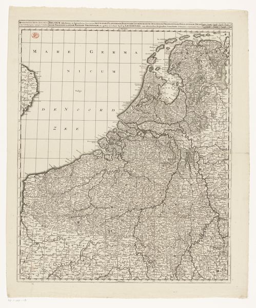
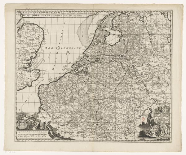
Dimensions: height 603 mm, width 510 mm
Copyright: Rijks Museum: Open Domain
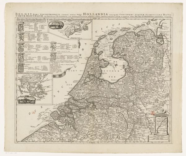
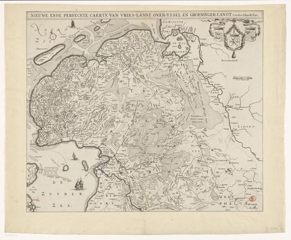
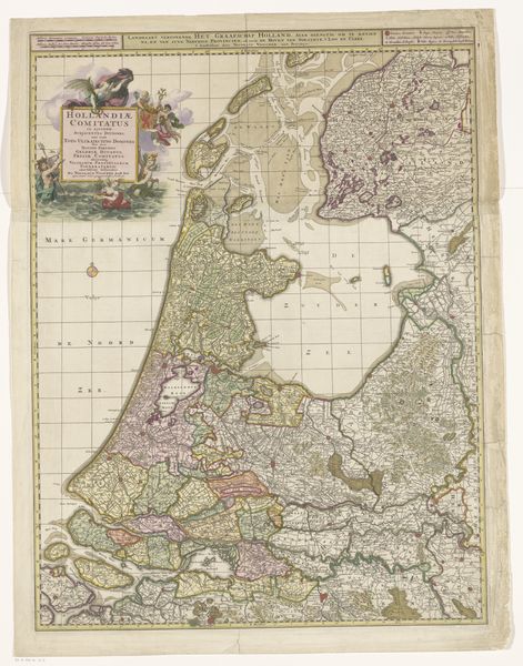
Editor: We’re looking at "Kaart van de Zeventien Provinciën," a print by Joachim Ottens, dating from between 1715 and 1737. It’s incredibly detailed. I'm immediately struck by how this map, ostensibly about geography, feels very political. What can you tell us about its historical context? Curator: Indeed. The map itself, meticulously engraved, represents not just land but also power. Consider that it's titled 'Map of the Seventeen Provinces', a political entity that ceased to exist in the late 16th century after the Dutch Revolt. Its creation in the 18th century, well after the separation of the Dutch Republic and the Spanish Netherlands, speaks volumes. Editor: So, it’s an idealized vision, perhaps? Curator: Precisely. It evokes a sense of shared history and perhaps a longing for a unified territory, particularly relevant considering the shifting allegiances and ongoing power struggles in Europe at the time. Who controlled these territories was constantly in flux. Editor: It’s interesting how a seemingly neutral object like a map can be so loaded. Does the visual style itself convey a particular message? Curator: Absolutely. The very act of mapping is an act of claiming. Notice the elaborate cartouche, figures, and heraldry. They weren’t just decorative; they served to legitimize authority and project an image of prosperity and strength. Consider how visual elements legitimized claims in that period. Editor: It makes me rethink the role of art in shaping perceptions of national identity. Thank you. Curator: And it reminds us that even what appears to be documentary evidence, like this map, is always a carefully constructed narrative. Food for thought.
Comments
No comments
Be the first to comment and join the conversation on the ultimate creative platform.
More like this