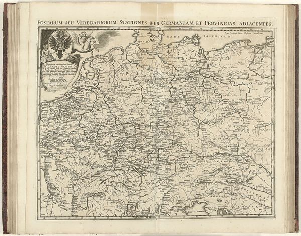
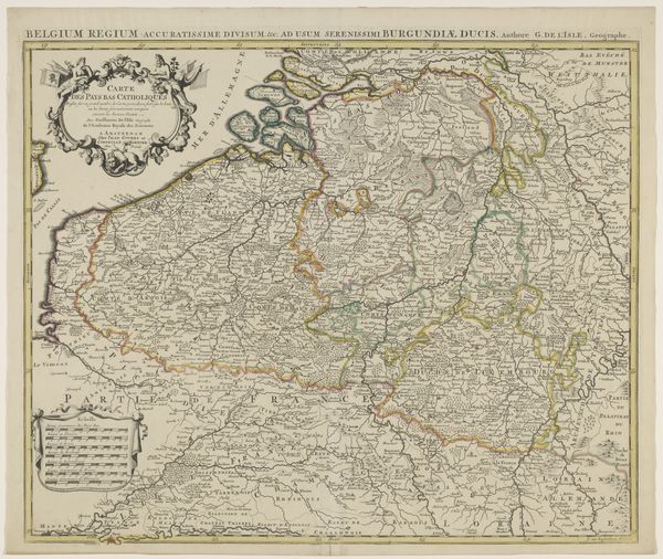
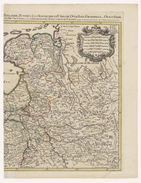
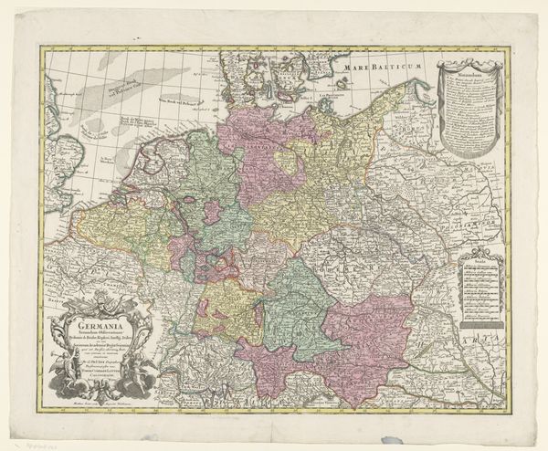
Kaart van Nederland, Duitsland, België en Denemarken waarop de postroutes zijn aangegeven 1726 - 1750
0:00
0:00
janstemmers
Rijksmuseum
print, etching, engraving
#
baroque
# print
#
etching
#
landscape
#
etching
#
geometric
#
line
#
engraving
Dimensions: height 518 mm, width 710 mm
Copyright: Rijks Museum: Open Domain
Editor: This etching, created between 1726 and 1750 by Jan Stemmers, maps out the postal routes of the Netherlands, Germany, Belgium, and Denmark. Looking at the intricate details, it feels almost like staring at a web of connections across the landscape. What catches your eye in this piece? Curator: Ah, yes, Stemmers. It's more than just geography, isn't it? Think of each line etched here as a pulse – trade, correspondence, the movement of ideas. And in that period, cartography wasn’t just about direction; it was power. I wonder, how much was known – and what remained an imagined frontier? The blank spaces on the map hint at more than just unknown landscapes. They spark my imagination. Do you find yourself wondering about what stories these silent routes might tell? Editor: That's a beautiful way of putting it! I never thought about the "silent routes" and all the human stories that are attached to them. What about the baroque styling and use of lines? What do you make of those stylistic choices? Curator: Good eye! The baroque flair probably stems from wanting to convey authority and trustworthiness, something essential in mapmaking, which served political needs. I find myself wondering if, in that flourish, something vital in translation has been lost, or whether a sense of drama enhances this landscape. Does it remind you of anything that's perhaps happening today? Editor: Hmmm… perhaps like the internet and digital connection today? That's pretty cool to consider. Curator: Exactly! Information flowing – then by coach and courier, now by fiber optics. Different means, similar needs. And the same dance between revealing and concealing knowledge. Perhaps now even more subtle and sly? Editor: Fascinating to consider parallels between past and present. This definitely offers food for thought about networks and the flow of information.
Comments
No comments
Be the first to comment and join the conversation on the ultimate creative platform.
More like this