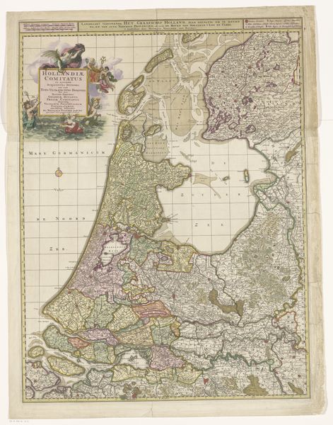
print, etching, paper, engraving
# print
#
etching
#
landscape
#
etching
#
paper
#
engraving
Dimensions: height 750 mm, width 566 mm
Copyright: Rijks Museum: Open Domain
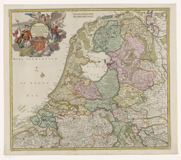
Curator: Looking at this map, I am struck by its exquisite, almost painterly detail—a beautiful dance of order and suggestion. Editor: Absolutely. What strikes me immediately is the sheer *density*. So many little lines crammed onto one sheet. It feels incredibly alive. Curator: We are viewing "Kaart van het graafschap Holland" – that’s “Map of the County of Holland” – dating approximately from 1690 to 1775. It’s a print comprised of etching and engraving, attributed to Gilliam van der Gouwen. What interests me is thinking about cartography, not as a neutral act, but as an expression of power. How did mapping affect social change and impact individual lives? Who gets represented—and how? This artwork opens so many important discussions. Editor: I can totally see that, the idea of maps as both document and declaration. But on a more visceral level, all these intricate waterways make me think about fluidity, connection, but also constant negotiation. Like, how did the people who lived there manage these lands, balance the waters, what can we say about Dutch identity? Curator: Indeed. The very act of depicting territory stakes a claim, and Holland, of course, had a significant colonial presence globally in the late 17th and 18th centuries. We can also think of cartography as deeply intertwined with trade and travel. Editor: Hmmm, for me it has to do with this overwhelming *feeling* of being immersed in something so detailed and sprawling, to scale... to be able to connect with those times, almost intimately... there's beauty to be found there too. Curator: I appreciate you calling attention to the human element. A map also records histories lived in specific places, the experience of being and dwelling in those sites across generations. Editor: Right! It’s a blend of art, science, politics... it feels rich with potential. Curator: I think exploring artworks in dialogue with one another helps expand our perceptions and deepen our understanding. Editor: Couldn't agree more. A nice journey.
Comments
No comments
Be the first to comment and join the conversation on the ultimate creative platform.
More like this