painting, watercolor
#
aged paper
#
toned paper
#
dutch-golden-age
#
painting
#
landscape
#
tea stained
#
watercolor
#
botanical drawing
#
watercolour bleed
#
watercolour illustration
#
genre-painting
#
natural palette
#
botanical art
#
watercolor
#
warm toned green
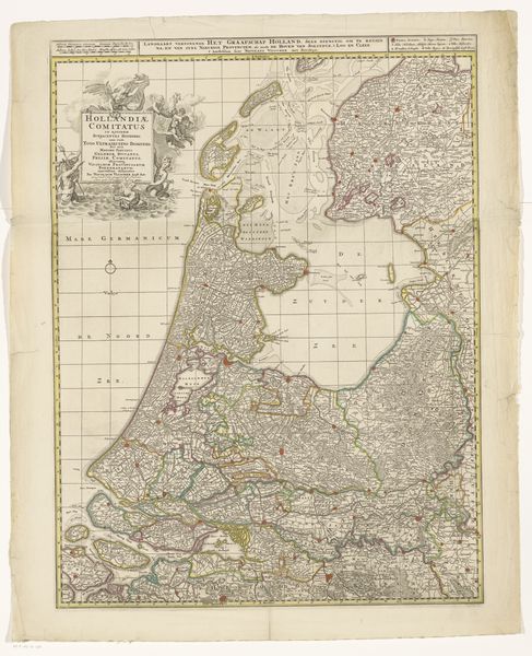
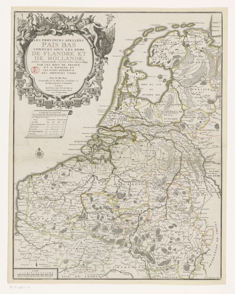
Dimensions: height 759 mm, width 572 mm
Copyright: Rijks Museum: Open Domain
Gilliam van der Gouwen produced this map of Holland, an engraving, sometime before his death in 1740. The composition is striking, divided between the geometrical precision of the landmasses and the elaborate, allegorical cartouche floating above. Delicate lines define regions and waterways, while soft colors differentiate territories. We can think of this map as a semiotic system where each element functions as a sign, contributing to the overall narrative. Van der Gouwen’s Holland is not just a geographical space, but also a political and cultural entity. The decorative elements, such as the cherubic figures, serve as cultural codes, enhancing Holland’s status. The very act of mapping involves choices. What to include, what to emphasize, what to omit? The mapmaker creates a particular vision, a specific representation of power and knowledge. This map challenges the notion of a fixed, objective reality, revealing how the construction of space is itself a form of cultural and political expression.
Comments
No comments
Be the first to comment and join the conversation on the ultimate creative platform.
More like this