graphic-art, print, engraving
#
graphic-art
#
dutch-golden-age
# print
#
old engraving style
#
geometric
#
line
#
history-painting
#
engraving
#
regionalism
#
realism
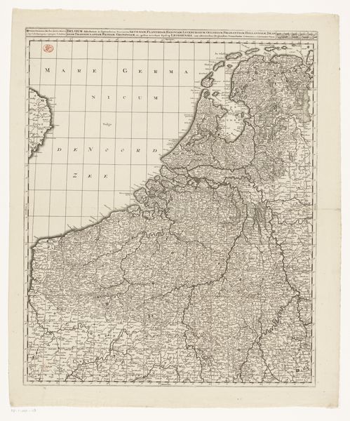
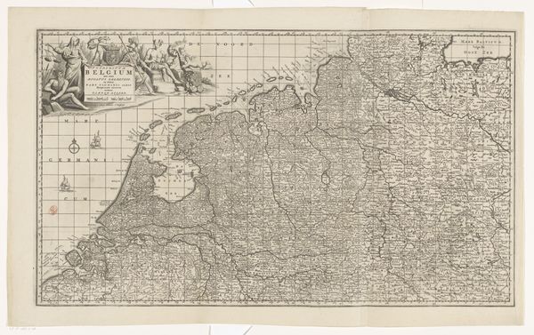
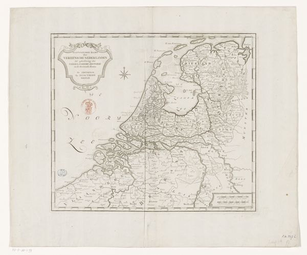
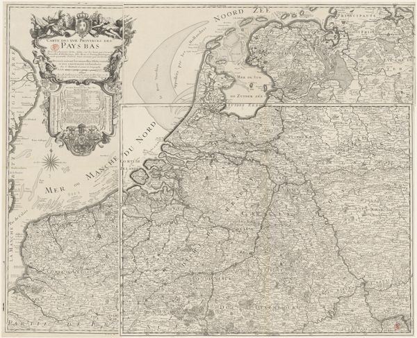
Dimensions: height 479 mm, width 560 mm
Copyright: Rijks Museum: Open Domain
Editor: Here we have a graphic print, "Kaart van de Republiek der Zeven Verenigde Nederlanden," a map of the Dutch Republic made after 1670 by Frederik de Wit. It's fascinating to see this landscape rendered with such precision. What jumps out to you as you examine this piece? Curator: It sings of a nation in the making, doesn't it? Beyond just lines on paper, it's a portrait of ambition and identity forged during the Dutch Golden Age. The delicate engraving breathes life into the landscape. It almost whispers tales of merchant ships braving open seas, or bustling cities. It also presents such a considered balance between geographic realism and symbolic flourish. Do you see that cartouche in the upper-left corner? Editor: I do, the allegorical figures flanking the title give it such a grand air. How would these kinds of flourishes be perceived then? Curator: Then, as now, such embellishments served as visual cues, suggesting power, prosperity and a touch of divine favor, perhaps? The map isn’t simply documenting space, it’s staking a claim. It suggests this isn't just a place but a burgeoning nation, a powerhouse on the world stage. Think about the colors. What feeling do they provoke? Editor: They feel very austere and precise, highlighting a focus on science and reason! It is easy to consider maps being objective now, but I never thought about their capacity for carrying nationalistic symbolism. Thanks so much for this breakdown! Curator: My pleasure! It’s through shared discoveries like these that artworks truly come alive, isn't it?
Comments
No comments
Be the first to comment and join the conversation on the ultimate creative platform.
More like this