graphic-art, print, engraving
#
graphic-art
#
dutch-golden-age
# print
#
geometric
#
engraving
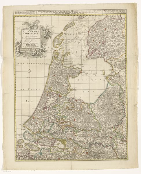
Dimensions: height 527 mm, width 412 mm
Copyright: Rijks Museum: Open Domain
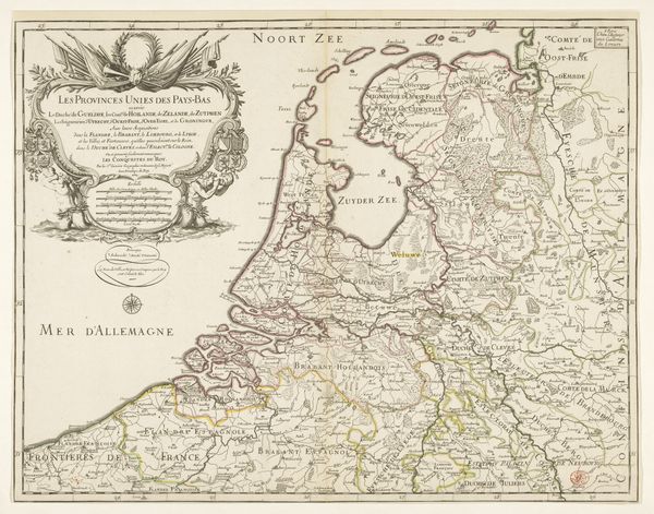
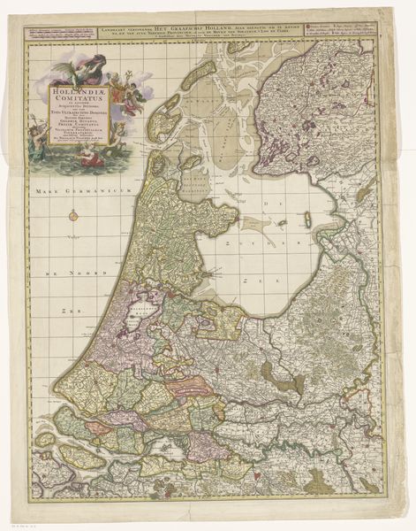
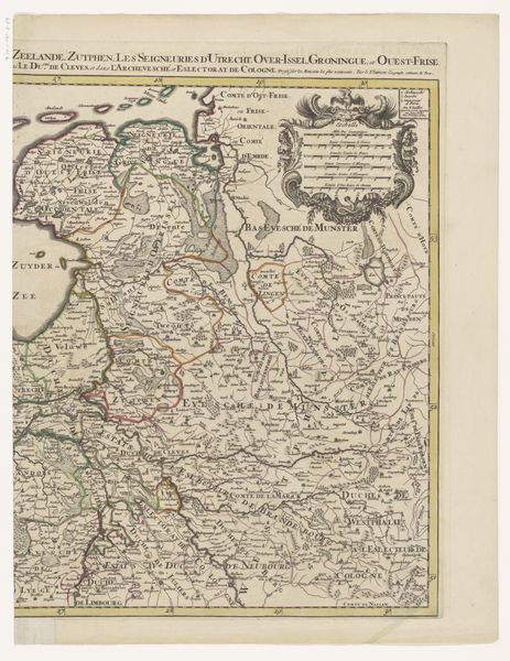
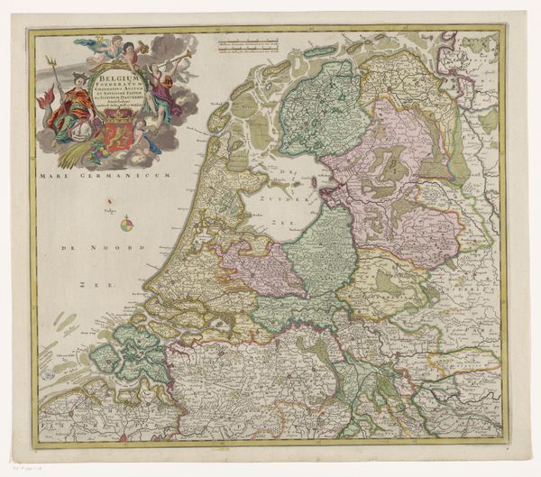
Curator: Just look at this stunning print! "Kaart van de Zeventien Provinciën" by P. Starckman, sometime before 1710. The precision, the delicate engraving... it’s practically a poem in ink. Editor: It’s… busy. My eyes dart all over the place. It gives the immediate impression of political wrangling solidified on paper. So many borders! It must have been a tense time. Curator: Indeed. The Dutch Golden Age was a whirlwind of trade and conflict. What strikes me is the way information became a commodity in its own right. Think about the material production. An engraver meticulously transferring the surveyors' and cartographers' knowledge, cutting away tiny pieces of metal. Each line, each word is intentional. Editor: Right, the labor of it all! These weren't mass-produced, churned out by a machine. An artisan meticulously planned each mark. I bet they had specific tools, workshops filled with specialized labor, the smells of metal and ink, apprentice mistakes piling up… each print has a story of making encoded in its lines. You said print, what specific form did this take? Curator: Starckman primarily worked with engravings, meaning they etched into a metal plate to create the image. You see it in the incredible fineness of the lines describing the landscapes. A lot of skill to pull the plate up and create this detailed composition. Editor: It looks like quite the feat of precision. I suppose it goes beyond accurate depiction of space: the swirls of ornamentation give it authority, marking it for high office or military campaign strategies. But was there more to this map than geographical exactitude and military campaigns? Was this also about wealth distribution through resource extraction from land and sea, power, land ownership? Curator: Of course! All intertwined. The map visually reinforces the perceived value of these lands. You've got decorative flourishes that almost resemble propaganda: emblems of power, idealized figures representing prosperity... this was a way of claiming the territory as much as depicting it. But even the printing press facilitated its creation; a relatively small business such as this shows the wide impact and economic benefit from it. Editor: It makes you wonder about the role maps played in shaping perceptions. To make people desire land to stake claims. We’re always so critical of what we consume now, we might even look at printed work then. Curator: Exactly! I keep thinking about this tension, between beauty and pragmatism, art and utility, that breathes within this seemingly simple map. It's a history lesson, a geography lesson and a stunning piece of art! Editor: Yes, the hand that made this artwork would feel very real holding this artwork. Something very different compared to digital production, right? Anyway, I’ve found myself thinking that with the materials in mind.
Comments
No comments
Be the first to comment and join the conversation on the ultimate creative platform.
More like this