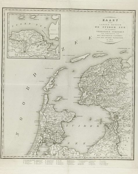
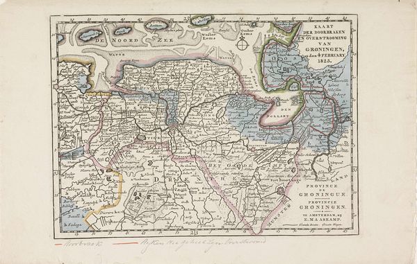
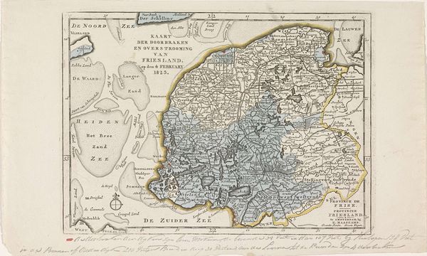
Kaart van het gebied in Noord-Holland getroffen door de overstromingen in 1825 1825
0:00
0:00
anonymous
Rijksmuseum
graphic-art, print
#
graphic-art
# print
#
landscape
Dimensions: height 247 mm, width 178 mm
Copyright: Rijks Museum: Open Domain
This map depicts the area in Noord-Holland struck by the floods of 1825. The stark imagery of the map, delineating land and water, immediately calls to mind our primal relationship with the elements. Historically, maps are not just about geography; they are cultural artifacts laden with symbols of power, control, and understanding of our world. In the collective memory, water often symbolizes chaos and the untamed, a force that can both nourish and destroy. Consider the compass rose, a recurring motif in cartography. Here, it’s a guide, but also a reminder of humanity’s attempt to orient itself amidst the unpredictability of nature. Think of similar symbols across cultures – the serpent representing both healing and destruction. Such recurring symbols aren't merely decorative; they tap into deep-seated fears and hopes, engaging us on a subconscious level. The flood, a symbol of cleansing and destruction, resurfaces time and again in myths and legends, evolving in meaning yet retaining its emotional power.
Comments
No comments
Be the first to comment and join the conversation on the ultimate creative platform.
More like this