print, ink, engraving
#
dutch-golden-age
# print
#
ink
#
geometric
#
decorative-art
#
engraving
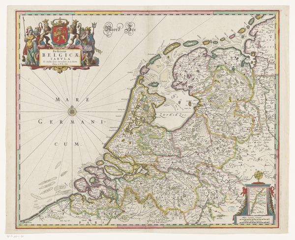
Dimensions: height 660 mm, width 820 mm
Copyright: Rijks Museum: Open Domain
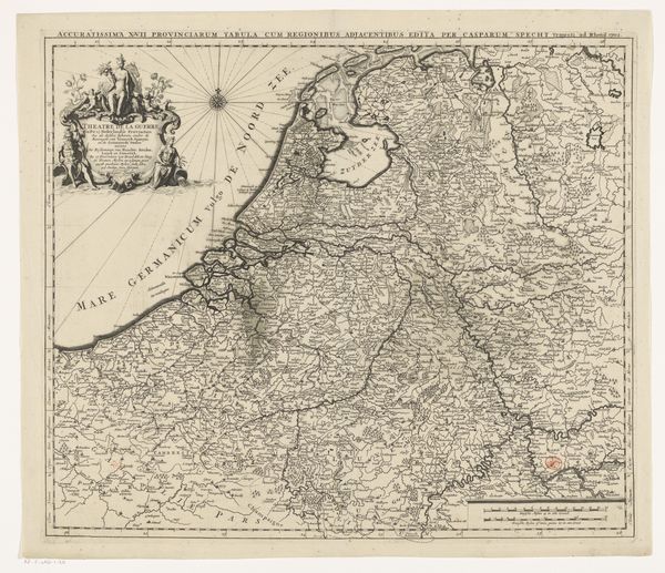
Charles Inselin’s “Map of the Seventeen Provinces” is a detailed engraving, approximately 66 by 82 centimetres. The stark contrast of fine lines against the pale paper draws the eye into a complex network of geographical markers. A visual tension is set up between the natural, organic forms of coastlines and rivers, and the precise geometric shapes dividing territories. Inselin's map can be interpreted as an exercise in ordering and controlling space through visual representation. Each province is delineated not just by lines but also by implication, suggesting a structural framework that imposes a clear hierarchy. The map’s function, therefore, transcends mere geographical documentation, becoming a semiotic instrument. Note the elaborate cartouche and heraldic symbols adorning the upper left, these are not merely decorative, they reinforce the map as an assertion of power, reflecting a belief in the order and rationality of governance projected onto the physical landscape. It invites us to consider how maps, as constructed images, can shape and reinforce our understanding of political and cultural territories.
Comments
No comments
Be the first to comment and join the conversation on the ultimate creative platform.
More like this