print, engraving
#
baroque
# print
#
geometric
#
line
#
history-painting
#
decorative-art
#
engraving
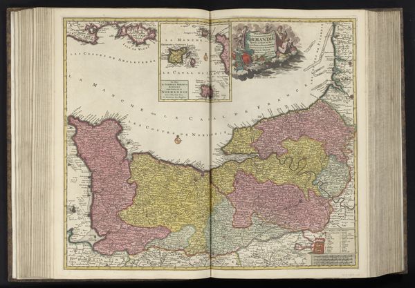
Dimensions: height 512 mm, width 587 mm
Copyright: Rijks Museum: Open Domain
Theodorus Danckerts created this ‘Sea Chart of the Channel’ without a specified date, using engraving as his medium. Notice how England and France are rendered in different colors and tones, a structural technique to visually separate the geopolitical entities. Danckerts uses line and color to create a sense of order and orientation but also conveys a rich array of data. This map isn't just a depiction of geography; it's a semiotic system that signifies power, knowledge, and the relationship between nations. The visual organization with navigational lines demonstrates the early modern period's emphasis on empiricism, navigation and scientific exploration. Consider how the embellishments like the cherubs and the figure of Navigation add layers of meaning. These figures function as cultural symbols, invoking classical allegories and associating maritime exploration with divine favor and intellectual prowess. The ‘Sea Chart of the Channel’ is therefore not only a functional tool but also an elaborate statement about cultural and political ambitions.
Comments
No comments
Be the first to comment and join the conversation on the ultimate creative platform.
More like this