graphic-art, print, engraving
#
graphic-art
#
baroque
# print
#
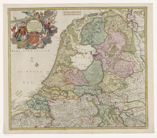
landscape
#
history-painting
#
engraving
Dimensions: height 497 mm, width 590 mm
Copyright: Rijks Museum: Open Domain
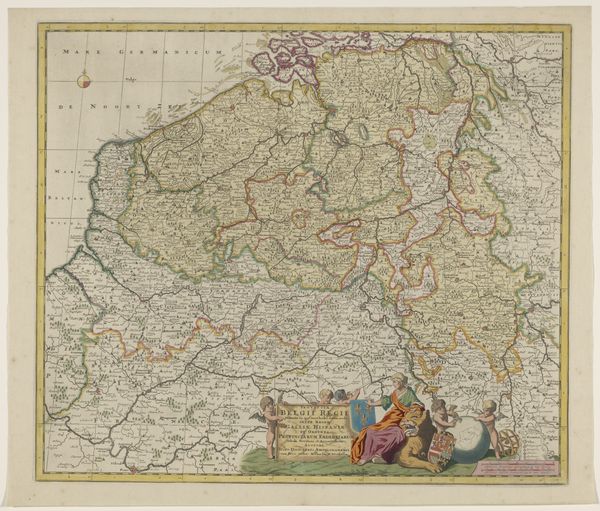
Editor: This is an engraving from 1704, "Kaart van de Zeventien Provinciën," displayed here at the Rijksmuseum. The cartographer is anonymous, but the level of detail is remarkable. It’s quite an impressive piece! I’m struck by the amount of labor involved. What is most significant about this map for you? Curator: The engraving immediately highlights the meticulous labor and craft embedded in map-making during the Baroque period. The production itself — the lines etched into the plate, the ink meticulously applied, and the paper used — reveals a sophisticated industry. Consider the consumption: who used this map and for what purposes? Its materiality speaks to the economic and political imperatives of the time. Editor: So, less about the geographical representation itself, and more about the how and why it was made and used? Curator: Precisely. The map is a commodity, born from a confluence of skilled labor, materials sourced, and a specific social context demanding accurate spatial representation for trade, governance, or military campaigns. Note the embellishments too. Do these signify something beyond mere aesthetics? Editor: Yes, they give authority, maybe? Reminds me that map-making was power. What the cartographer included or left out meant something, right? Curator: Absolutely. Whose resources are being mapped and for whose benefit? Maps dictate land ownership, trade routes, resource control, military logistics and geopolitical strength. Consider how this particular map participated in shaping those power dynamics within the Seventeen Provinces, which now roughly comprises the Netherlands, Belgium, Luxembourg, and parts of northern France and western Germany. Editor: I hadn't thought about it that way before. Now, I’m starting to see the map less as a straightforward representation and more as a document of early modern production and power. Curator: Exactly, thinking materially helps deconstruct our understanding.
Comments
No comments
Be the first to comment and join the conversation on the ultimate creative platform.
More like this