print, engraving
# print
#
landscape
#
11_renaissance
#
flemish
#
engraving
#
watercolor
Dimensions: height 370 mm, width 487 mm
Copyright: Rijks Museum: Open Domain
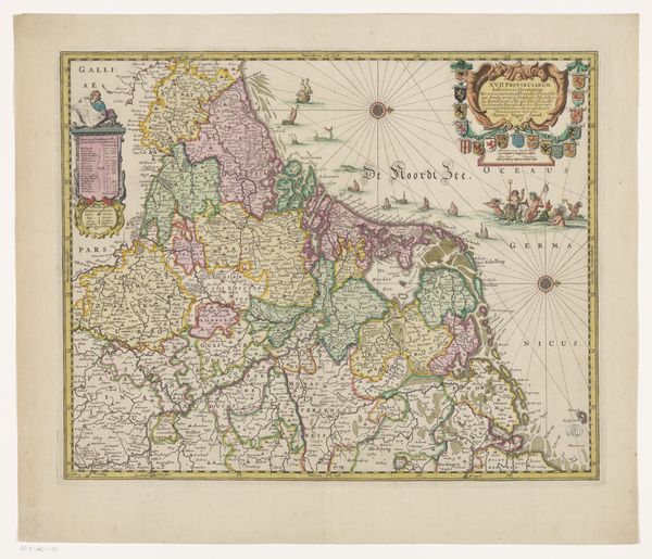
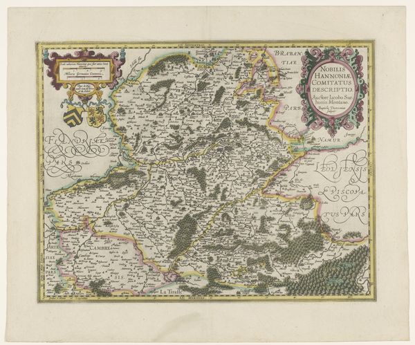
Curator: Well, what do you make of this "Kaart van het graafschap Henegouwen"—"Map of the County of Hainaut"—dating all the way back to 1592? It's attributed to a cartographer going by the moniker of Jacob van Surhon. Editor: First impression? It looks…organized. Intricate, almost obsessively so. It's not just a map; it's a declaration. It’s trying to tame the land. The colors are lovely—muted greens and golds, almost autumnal. It's comforting, yet strangely distant, you know? Like a beautiful dream of a place. Curator: A declaration of control, you say? It’s certainly that. Look at the symbols—forests carefully demarcated, settlements rendered with almost mathematical precision. Maps like these were potent instruments of power in the Renaissance, reflecting ownership and strategic vision. But you noticed the muted tones. Did you also see that these subtle colors serve as more than just decoration? They distinguish political territories and trace the complex, winding waterways so essential for commerce and governance. Editor: It’s the detail that really gets me. The tiny settlements, those winding paths that look suspiciously like wandering sheep trails—did folks actually read these maps while hiking about? Or were they for bigwigs scheming over goblets of wine? Curator: Possibly both! Maps of this kind certainly adorned the walls of the wealthy and powerful, whispering tales of ambition and land ownership, of course. But, look closely—you’ll see roads connecting even the smallest villages, indicating their importance in trade networks and social structures. These visual cues helped officials and merchants track goods and control trade. Think of this map as early spatial data visualizations to help create complex logistics. Editor: Right, that reminds me how power works. You always need data for effective logistics, no matter how you want to influence the life of everyman in your lands. So if maps embody ambition, then they represent it on more than one level. By organizing information, maps tell us about social hierarchies in terms of who gets access to the birds eye view and can make something out of all that raw data, versus who just deals with the facts on the ground. In a way, the ability to organize information, to even "tame the land", makes me uncomfortable about how easy it seems. Curator: Easy only in retrospect. I see your unease, but let’s not forget that this meticulous creation represents more than just ambition. It showcases Renaissance artistic and engraving skills. Imagine how a late 16th-century Flemish audience experienced this artwork! I think it filled them with the possibility of progress. Editor: Hmmm. Progress and pretty pictures. It's an intriguing and slightly unsettling blend. Curator: Indeed. That intersection continues to fascinate.
Comments
No comments
Be the first to comment and join the conversation on the ultimate creative platform.
More like this