graphic-art, print, paper, engraving
#
graphic-art
#
baroque
#
ink paper printed
# print
#
paper
#
engraving
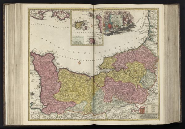
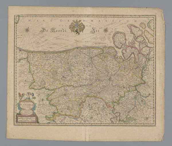
Dimensions: height 492 mm, width 600 mm
Copyright: Rijks Museum: Open Domain
Curator: Let’s take a look at this detailed, hand-colored map currently on display, "Kaart van Pays de la Loire en omliggende gebieden." It’s an engraving, printed on paper, dating from somewhere between 1685 and 1726, so the late Baroque era. Editor: Mmm, striking! Like a patchwork quilt crafted by a geographer. I immediately imagine quill pens scratching furiously across parchment, stained fingers, candlelit offices, secrets of the land revealed stroke by careful stroke... there's a real romance to it. Curator: The coloring, I believe, enhances that feeling. See how the regional borders are delineated with such firm colored lines, defining territories and reflecting the political landscape of the time. Cartography then wasn’t merely about geographical accuracy; it was also a declaration of power. Editor: Absolutely. Though power also lives in what’s not shown. I wonder about the everyday lives hidden within these colored shapes. Those tiny villages. The untold stories beneath the names...what was it like for farmers there in 1700, do you imagine? Hard labor, certainly... but moments of exquisite peace, I like to think so. Curator: It would have varied greatly from region to region, of course, depending on feudal obligations and land ownership. But the creation of a map like this also facilitated more effective tax collection, resource management, and military planning. Knowledge *was* power, literally illustrated. Editor: Of course, practicality wins. But there is still such inherent beauty here; such craftsmanship, isn’t there? The flourishes in the lettering, the sheer commitment to detail, they imbue this piece with such personality. Curator: Yes, indeed, while it served very real administrative and strategic purposes, these maps simultaneously became coveted collectors' items, showcasing status, wealth, and an aspiration towards enlightenment values. Editor: Looking at it, it truly invites us to not just read it, but imagine it as a story, whispering its tales of forgotten paths and lives of long ago. Curator: Precisely. That interweaving of history and imagination is, I believe, where art truly breathes.
Comments
No comments
Be the first to comment and join the conversation on the ultimate creative platform.
More like this