print, etching, engraving
#
baroque
#
ink paper printed
# print
#
etching
#
landscape
#
geometric
#
engraving
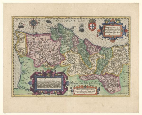
Dimensions: height 503 mm, width 605 mm
Copyright: Rijks Museum: Open Domain
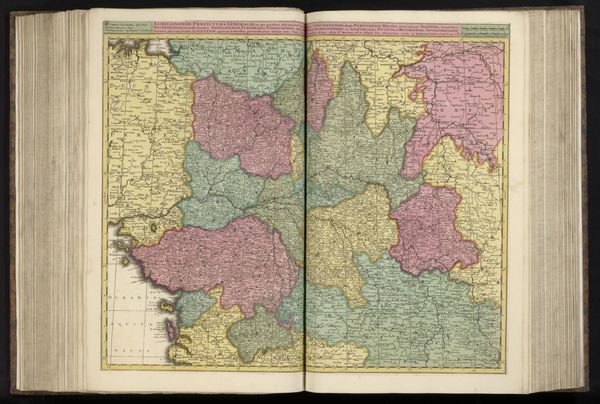
Curator: This is an etching with engraving on paper, titled "Kaart van Normandië met Guernsey en Jersey," essentially a map of Normandy with Guernsey and Jersey. It's anonymous, dating from somewhere between 1671 and 1706 and part of the Rijksmuseum's collection. Editor: My first impression? Utter precision, almost sterile, and a quiet assertion of dominion. The pastel color washes only amplify that initial detachment, don't you think? Curator: Absolutely. See how the engraver delineates space, marking out territory, possessions, property through hard lines? The baroque flair—the embellishments—try to hide the assertion of ownership, I wonder who commissioned this and what this map was made for? To possess land through representation… interesting concept. Editor: Well, it's definitely successful on that level! The topographical details read quite well. There's something about the cartographic lines, the dedication to geometric accuracy that provides some semblance of objective authority. The washes of pastel somehow lend a softening, persuasive influence that says come, and wander over my property, explore, invest and live. Curator: Good point about the objective authority thing—maps were serious business. The inclusion of those little vignettes, like the figures lounging near the title, that softens it too, making it more palatable than a simple grid, which is interesting as these kind of scenes became an almost essential element. Editor: Semiotics. I agree, the vignettes introduce narrative and identity into an otherwise abstract space. But, speaking to that grid... Look how the map utilizes sections and subsections within the divisions; like smaller properties sitting inside others. An almost fractal layering going on that mirrors our reality... Curator: Fractals of ownership. I love that, you are right it is echoing our material realities in fascinating and complex ways. This piece seems to capture a period when place was becoming space: when territory transforms into representation. A transformation from ownership to control… Very prescient! Editor: Agreed. Ultimately, it underscores how even seemingly objective forms, like maps, are imbued with power and perspectives. Something to keep in mind.
Comments
No comments
Be the first to comment and join the conversation on the ultimate creative platform.
More like this