drawing, paper, ink
#
drawing
#
landscape
#
river
#
paper
#
ink
#
coloured pencil
#
cityscape
Dimensions: height 182 mm, width 230 mm
Copyright: Rijks Museum: Open Domain
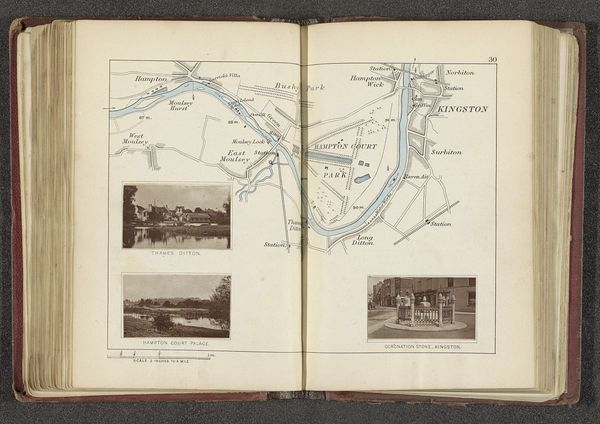
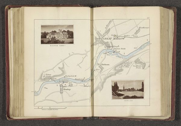
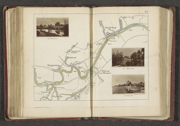
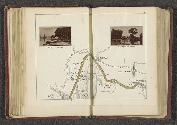
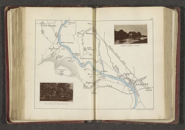
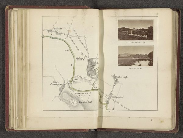
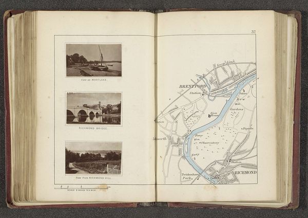
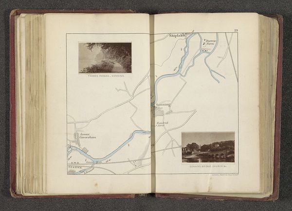
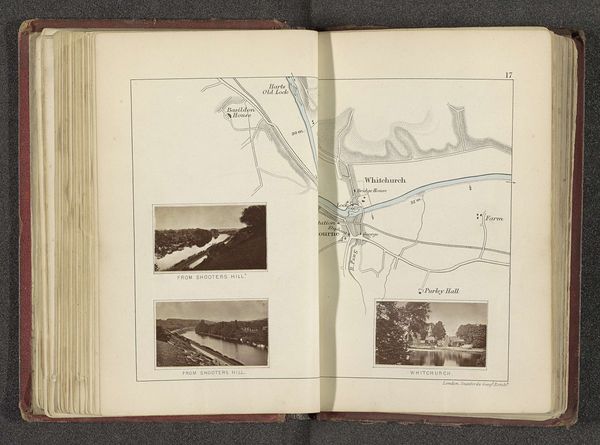
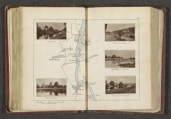
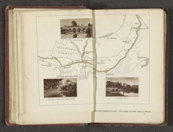
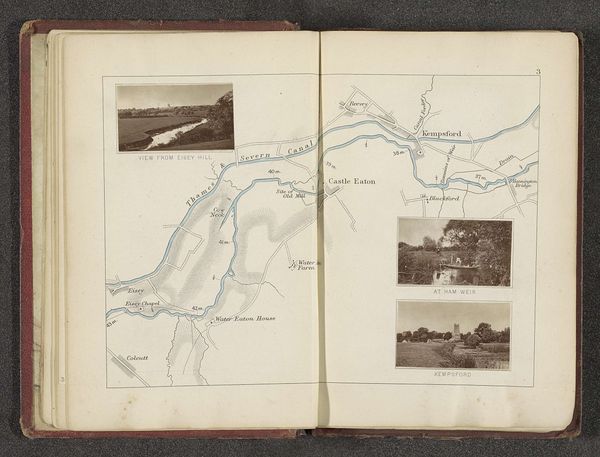
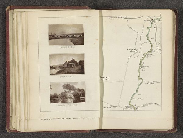
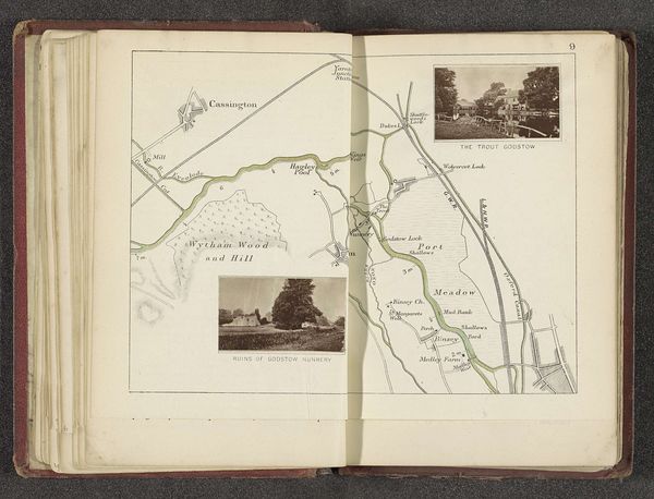
Curator: This is “Kaart met drie afbeeldingen van plaatsen langs de Theems in Londen” or "Map with three images of places along the Thames in London," made before 1879 by Henry W. Taunt. The materials include ink, colored pencil, and drawing on paper. Editor: It's such a delicate, intricate work. I’m immediately drawn to the way the artist intertwines the map with pictorial vignettes; the Thames snakes through the city, simultaneously charting territory and offering picturesque views. It makes me think about London's history of social stratification with access to landscapes being dictated by privilege and capital. Curator: Exactly, notice how Taunt has combined mapping with pictorial representation, creating an inventory and celebration of London’s infrastructure: Houses of Parliament, Putney and Hammersmith Bridges are rendered in detail. I find the technical execution of both the linear cartography and the miniature landscape depictions quite interesting; especially if we think of London's booming print industry, using drawing as an archival material to build cultural narratives. Editor: It feels like an invitation for the viewer to trace not just the geographical layout, but the political and cultural layers inherent to it, the history embedded into the cityscape. Think about who had access to navigate the river or enjoy these particular views at the time, the labour underpinning construction works such as bridges. Who really benefited? It sparks a series of socio-political questions. Curator: I agree. The industrial advancement suggested by the bridges juxtaposed with the implied leisure activity on the Thames raises interesting questions. You have the map itself becoming a tool—or perhaps a commodity—to literally navigate this increasingly complex urban environment. What does this tell us about shifting patterns of leisure, transportation and emerging class structures that materialize through access to public space? Editor: Considering the time it was made, prior to 1879, the work offers a window into Victorian London and prompts us to consider our relationship with public spaces today. Curator: It serves as a reminder that representations of landscape are always intertwined with social, economic, and political dimensions. The landscape is a visual device, charged with meaning. Editor: Absolutely. A compelling blend of representation and social commentary, a window into London’s complex and layered identity.
Comments
No comments
Be the first to comment and join the conversation on the ultimate creative platform.
More like this