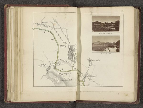
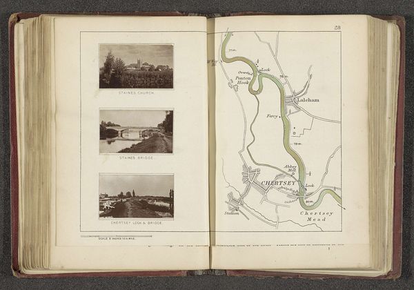
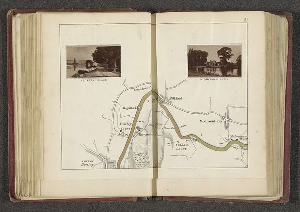
Kaart met twee afbeeldingen van de ruïne van het klooster en een forellenvijver bij Godstow before 1879
0:00
0:00
print, paper, watercolor
# print
#
landscape
#
river
#
paper
#
watercolor
#
coloured pencil
#
cityscape
#
watercolor
Dimensions: height 163 mm, width 236 mm
Copyright: Rijks Museum: Open Domain
Editor: This page, "Kaart met twee afbeeldingen van de ruïne van het klooster en een forellenvijver bij Godstow" by Henry W. Taunt, likely dating before 1879, blends a watercolor map with inset photographs. It's so interesting how the detailed map contrasts with the faded quality of the photographs, lending the page a bittersweet, historical aura. What strikes you most when you look at this? Curator: Well, immediately I'm transported! It's not just a map; it's a portal, wouldn't you agree? To a time when seeing a place involved a very different kind of seeing – slower, more mediated, and handcrafted. It speaks volumes about how we used to record and remember landscapes, interweaving the precise with the pictorial. Tell me, does the map's aesthetic remind you of anything specific? Perhaps a childhood memory of pouring over adventure books? Editor: Actually, yes! I remember devouring old maps in adventure books, which made everything feel so tangible. Curator: Exactly! There's a distinct romanticism to that bygone era. Also, consider the intention here – combining practicality with pictorial memories, documenting "the Trout Godstow" and "Ruins of Godstow Nunnery" alongside a geographical layout. Almost as if Taunt is inviting us to consider not just 'where' but 'what once was'. And the ruins, almost wistful, right? Editor: Definitely. It’s like he's highlighting the layers of history within the landscape. Curator: Precisely! And don't you think it's a subtle comment on change, remembrance, and how places evolve in our minds as much as in reality? That melding of medium—watercolors with what I presume are early photographic prints—makes me wonder about how technologies influence each other to affect not only artistic choices but cultural memory as well. A puzzle and a poem. What an intriguing juxtaposition. Editor: I hadn’t thought of it that way before. Thanks for opening my eyes to those layers of interpretation. I'll certainly remember that when looking at similar works. Curator: Anytime. That’s why art continues to fascinate—it’s not merely looking; it is experiencing thought made tangible.
Comments
No comments
Be the first to comment and join the conversation on the ultimate creative platform.
More like this