print, etching, engraving
#
baroque
#
dutch-golden-age
# print
#
etching
#
landscape
#
engraving
Dimensions: height 479 mm, width 585 mm
Copyright: Rijks Museum: Open Domain
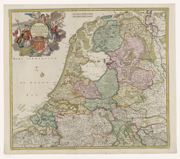
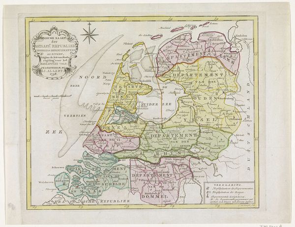
Gerard Valck created this map of the Dutch Republic, etched in ink, a testament to a nation’s identity. Observe the allegorical figures adorning the map. These are not mere decorations, but carriers of potent symbolism. The seated woman with overflowing cornucopia represents abundance and prosperity, invoking the classical motif of Fortuna, the goddess of fortune. Winged putti flutter about, symbols of divine favor, their presence echoing the cherubic figures found in Renaissance art. This map, therefore, does more than chart land; it visually asserts the Dutch Republic’s blessed status. Consider how such symbolism has been continually adapted. In ancient Rome, Fortuna embodied the capricious nature of fate, a force to be appeased. Here, she is reimagined as a guarantor of national success. This transformation speaks to our collective desire to impose order on the unpredictable currents of history, shaping our destiny through potent visual metaphors.
Comments
No comments
Be the first to comment and join the conversation on the ultimate creative platform.
More like this