drawing, graphic-art, print, paper
#
drawing
#
graphic-art
#
baroque
# print
#
paper
#
watercolor
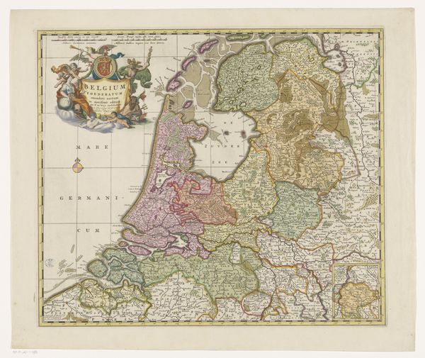
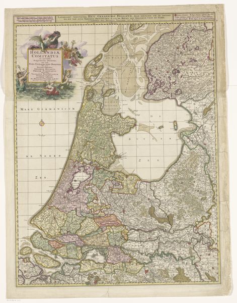
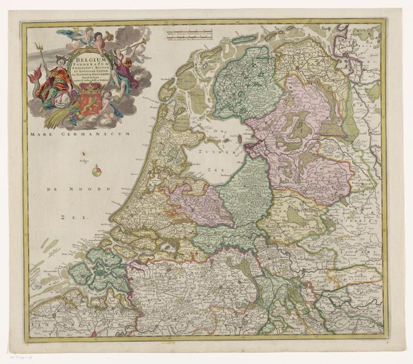
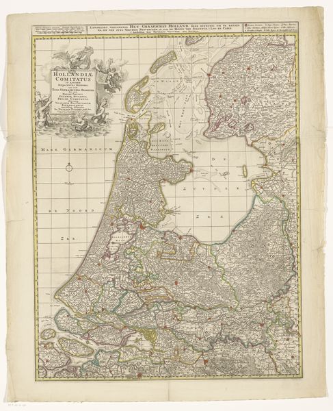
Dimensions: height 511 mm, width 599 mm
Copyright: Rijks Museum: Open Domain
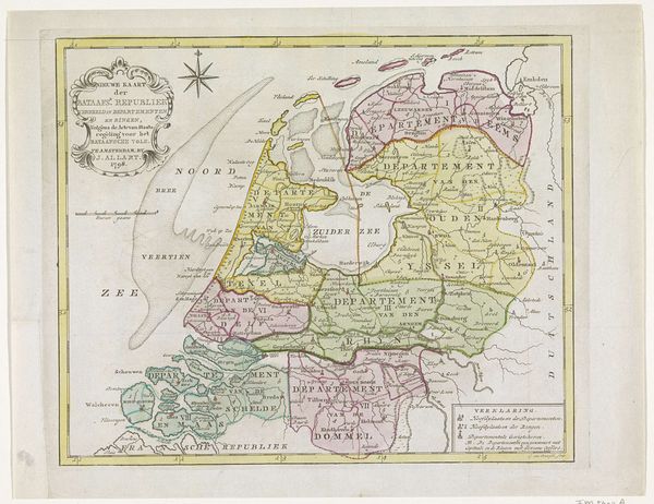
Curator: Looking at this map, the "Kaart van de Republiek der Zeven Verenigde Nederlanden" dating roughly between 1702 and 1750 and currently residing in the Rijksmuseum, I'm struck by the sheer level of detail in its rendering. It’s truly impressive given the production capabilities of the time. Editor: Immediately, I see not just a map, but a symbolic landscape. The decorative coats of arms along the left side read like characters in a story, each with its own distinct history and meaning waiting to be unpacked. Curator: Absolutely, these heraldic symbols function as signifiers of power and territory, a kind of visual shorthand denoting who controlled what at the time of the map's making. But also consider the labor—the cartographer, the engraver, the printing press operators, each contributing their specific skills. These maps would have been valuable commodities reflecting specific levels of tradecraft. Editor: Precisely! The very act of mapping a territory, claiming ownership through representation, is itself a powerful act. The compass rose for example, prominently displayed, suggests dominion over navigation, controlling movement. Curator: And think about the materiality: the paper, the inks, and the skills required to work with them all contribute to understanding it. We can learn a lot about resource accessibility in that period by knowing what materials were utilized. Editor: And don’t forget the colors. The subtle watercolors lend a human touch, a gentle quality, that almost belies the fierce political landscape it portrays. Notice the North Sea's position at the top of this 'theatre of power'–the sheer abundance of details. Curator: Right. The colors and the detail involved clearly show the relative importance ascribed to various locations, too. Think about how its dissemination influenced Dutch mercantilism. Its production value mirrors a deliberate economic imperative of the time. Editor: What intrigues me are the possible interpretations of this work within broader social and political symbolism, though I'm drawn back to my own personal experience with maps: navigation and stories waiting to be told through time. Curator: Indeed. And that, of course, speaks to a core truth about material production; these historical maps are also tools through which future developments unfold! Editor: It shows us not just where things are but what they signified and were believed to have signified—revealing complex beliefs about ourselves and the world.
Comments
No comments
Be the first to comment and join the conversation on the ultimate creative platform.
More like this