graphic-art, print, engraving
#
graphic-art
#
dutch-golden-age
# print
#
landscape
#
geometric
#
cityscape
#
engraving
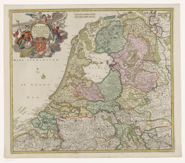
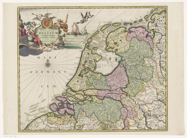
Dimensions: height 462 mm, width 558 mm
Copyright: Rijks Museum: Open Domain
This is Frederik de Wit's map of the Dutch Republic, printed with ink on paper. The map’s design is full of detail, which speaks to the reproductive capacity of printmaking, and its suitability for representing and ordering the world. The ink’s lines denote geographic features, borders and place names, all precisely rendered. It presents information as a commodity and tool for navigation. But there's also plenty of decoration, reflecting its economic value as a luxury object; the addition of color was a hand-applied process that would have raised its price. Consider how this image would have been made. An engraver cut the design into a metal plate; this was then inked and printed. As a business model, printmaking involved many different hands, from draftsmen to publishers, who were all working to make geographical knowledge accessible to a wider audience. It’s a great example of how craft and commerce worked together in the early modern period.
Comments
No comments
Be the first to comment and join the conversation on the ultimate creative platform.
More like this