print, etching
# print
#
etching
#
etching
#
geometric
#
history-painting
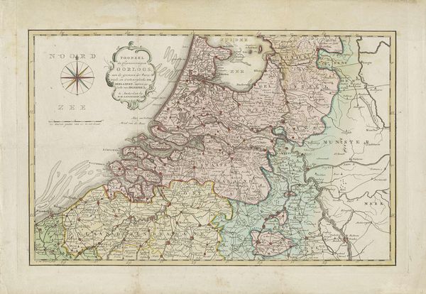
Dimensions: height 267 mm, width 330 mm
Copyright: Rijks Museum: Open Domain
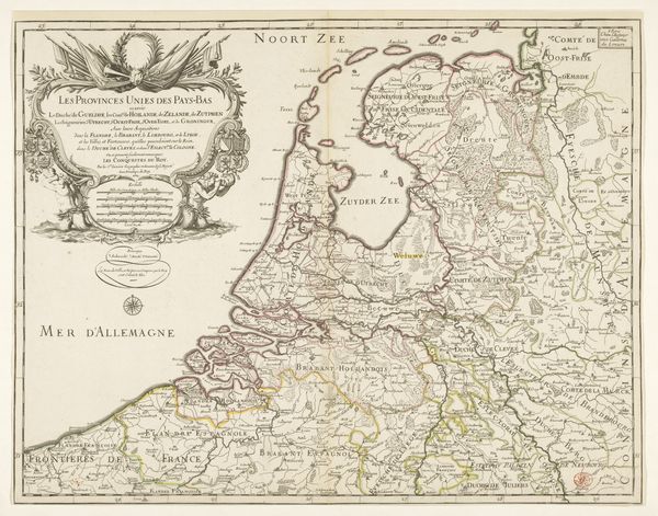
This map of the Batavian Republic was made in 1798 by Cornelis van Baarsel. Note the prominent compass rose, a symbol deeply rooted in the human quest for orientation and control amidst the unknown, here representing the newly formed Republic. The compass rose is not merely a navigational aid, it is a 'Pathosformel', an expressive formula, echoing through time. We see its predecessors in ancient star charts, guiding celestial navigation, and in medieval Christian art, symbolizing divine direction. The compass, in its essence, is an emblem of human ambition, yet also of our vulnerability in the face of the vast, indifferent cosmos. Like a mandala, the compass rose engages our subconscious, evoking a sense of order and purpose. It serves as a potent reminder of our enduring need to map not just the physical world, but also our place within it, both individually and collectively. This map offers a seemingly rational depiction of the Batavian Republic. However, the compass rose reminds us of the deeper, often irrational, currents that shape our understanding of the world.
Comments
No comments
Be the first to comment and join the conversation on the ultimate creative platform.
More like this