painting, watercolor
#
baroque
#
painting
#
landscape
#
watercolor
#
coloured pencil
#
history-painting
Dimensions: height 151 mm, width 223 mm
Copyright: Rijks Museum: Open Domain
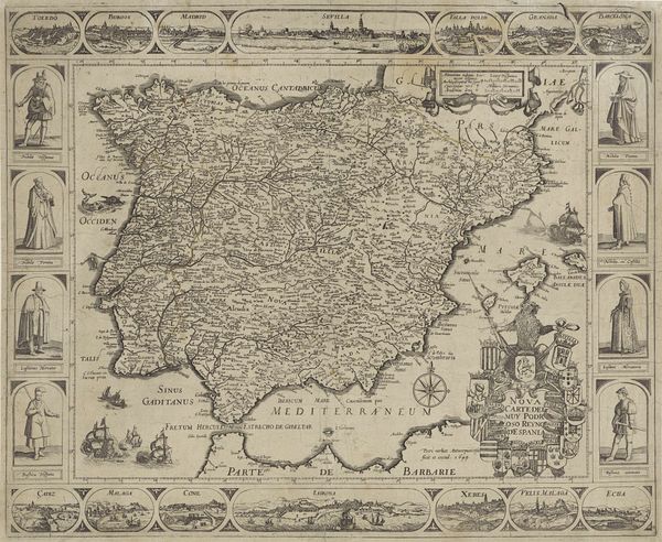
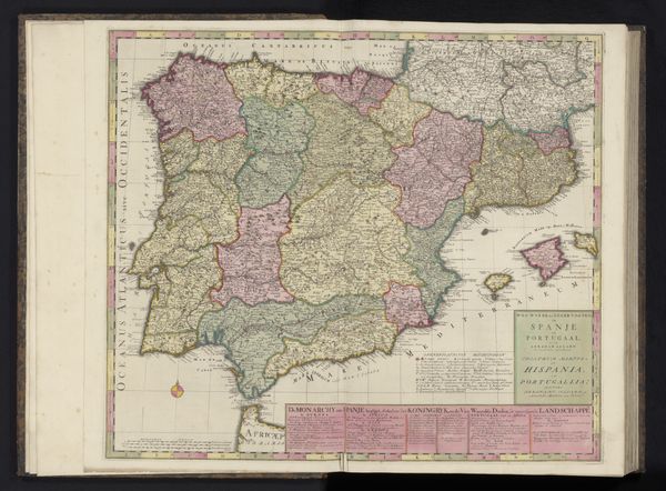
Editor: This watercolor painting, titled "Kaart van Spanje," or "Map of Spain," was made anonymously sometime between 1700 and 1735. What immediately strikes me is the delicate, almost whimsical use of color in rendering the geography. It feels both precise and fanciful. How do you interpret this work through a formalist lens? Curator: The painting presents a fascinating study in contrasts, precisely because of that interplay you observed. Note the tension between the highly structured, almost geometric rendering of the map's border and the more fluid, organic shapes of the landmasses themselves. Editor: I see that now. The hard edges of the frame, punctuated by heraldic symbols, versus the softer interior. Curator: Precisely. The choice of watercolor allows for subtle gradations in tone and color, which both define the terrain and lend an atmospheric quality. Notice also the considered application of these colors. Pink dominates Spain, green delineates Portugal— these aren't simply representational; they’re symbolic choices contributing to the overall design. Editor: Are the colors arbitrary then, or do they serve a purpose? Curator: Not arbitrary, but calculated for effect. Pink might suggest prosperity or prominence in that period. The green of Portugal establishes a clear visual distinction between the kingdoms, serving as a signifier of identity within the larger composition. How does that contribute to your understanding? Editor: It reframes how I view the piece. Before, I saw it as just a map. But now, I recognize the purposeful use of color and form beyond mere representation. Thank you for helping to view it in terms of how the different elements contribute to a comprehensive structure and meaning. Curator: Indeed, the rigorous execution elevates a simple map into an engagement with visual aesthetics, showcasing artifice as a vehicle for understanding function.
Comments
No comments
Be the first to comment and join the conversation on the ultimate creative platform.
More like this