drawing, print, engraving
#
drawing
#
rippled sketch texture
#
aged paper
#
baroque
#
pen drawing
# print
#
pen sketch
#
old engraving style
#
sketch book
#
hand drawn
#
pen-ink sketch
#
pen work
#
cityscape
#
engraving
#
intricate and detailed
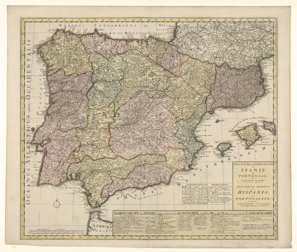
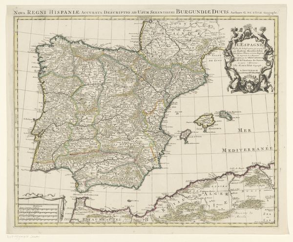
Dimensions: height 455 mm, width 653 mm
Copyright: Rijks Museum: Open Domain
This map of Spain and Portugal was etched by Pieter Verbiest the Younger in the 17th century, a time when cartography was as much about projecting power as it was about geography. Look closely and you'll see more than just cities and coastlines. The detailed vignettes of cityscapes across the top and bottom, and the costumed figures along the sides, reflect a society deeply aware of its own image and status. Spain, during this period, was a major player on the world stage, and maps like these were tools for asserting dominance and cultural identity. This wasn't just about showing where places were; it was about conveying a sense of wealth, order, and control. As historians, we dive into archives, scrutinize trade records, and study political pamphlets to understand the full story behind artworks like this. Only then can we really appreciate how art is always embedded in its time, reflecting and shaping the world around it.
Comments
No comments
Be the first to comment and join the conversation on the ultimate creative platform.
More like this