About this artwork
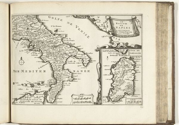
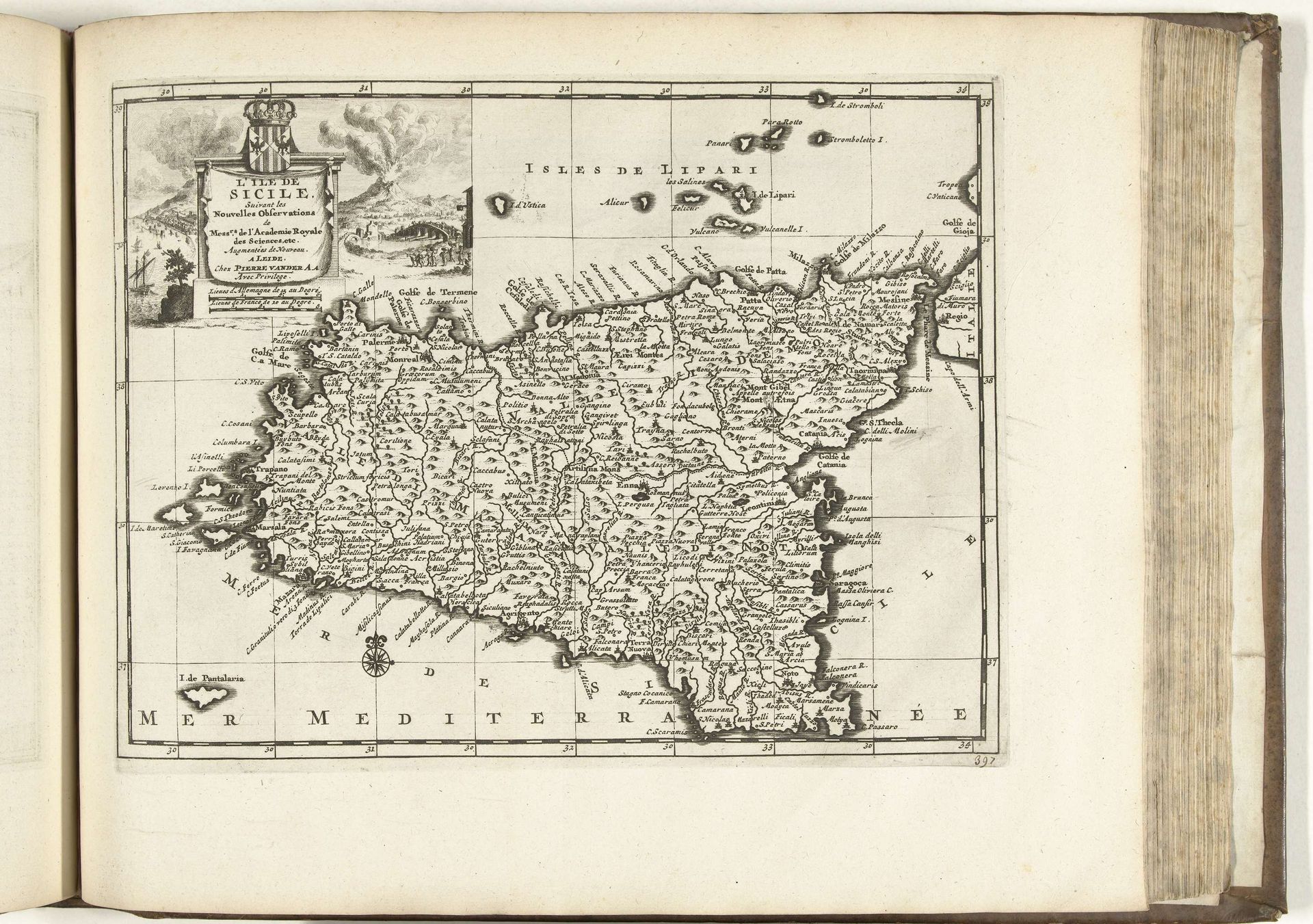
This is an anonymous map of Sicily from 1726. During this time, cartography was not just about geographical accuracy; it was deeply intertwined with power, politics, and identity. Think about what it meant to map a territory in the 18th century. It was an act of claiming space, defining boundaries, and asserting control. For the people of Sicily, being mapped by outsiders meant being subjected to external gazes and agendas. The map flattens their lived experiences into neat, measurable data. It emphasizes Sicily’s resources and strategic importance, potentially overlooking the cultural richness and the everyday lives of its inhabitants. Consider the emotional weight of seeing your home reduced to lines on a page, especially when those lines are drawn by someone who doesn’t share your history or understand your struggles. What stories are left untold in this representation? How does it shape our understanding of Sicily and its people? How does it reflect both societal and personal views of this place?
Artwork details
- Medium
- print, engraving
- Dimensions
- height 231 mm, width 301 mm
- Location
- Rijksmuseum
- Copyright
- Rijks Museum: Open Domain
Tags
Comments
Share your thoughts
About this artwork
This is an anonymous map of Sicily from 1726. During this time, cartography was not just about geographical accuracy; it was deeply intertwined with power, politics, and identity. Think about what it meant to map a territory in the 18th century. It was an act of claiming space, defining boundaries, and asserting control. For the people of Sicily, being mapped by outsiders meant being subjected to external gazes and agendas. The map flattens their lived experiences into neat, measurable data. It emphasizes Sicily’s resources and strategic importance, potentially overlooking the cultural richness and the everyday lives of its inhabitants. Consider the emotional weight of seeing your home reduced to lines on a page, especially when those lines are drawn by someone who doesn’t share your history or understand your struggles. What stories are left untold in this representation? How does it shape our understanding of Sicily and its people? How does it reflect both societal and personal views of this place?
Comments
Share your thoughts