drawing, print, etching, paper
#
drawing
# print
#
etching
#
landscape
#
paper
#
coloured pencil
#
geometric
#
history-painting
Dimensions: height 182 mm, width 265 mm
Copyright: Rijks Museum: Open Domain
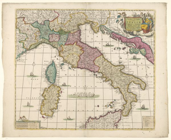
Here, we see a map of Italy by an anonymous artist. This map reflects a time when geographical knowledge was intertwined with political ambitions and cultural identity. The map presents not just a territory, but a concept of Italy as seen through the eyes of its creator. Notice how the regions are defined, and how cities are represented with pictorial emblems of power and commerce. What does it mean to frame a nation in this way? Consider the implications of mapping on identity, particularly during a time when Italy was a collection of city-states, rather than the unified nation we know today. The map invites us to consider how lines on a page can shape our understanding of belonging. It begs the question: Who is included, and who is left out? This map is more than ink on paper, it is an artifact of cultural desire.
Comments
No comments
Be the first to comment and join the conversation on the ultimate creative platform.
More like this