drawing, print, engraving
drawing
baroque
coloured pencil
engraving
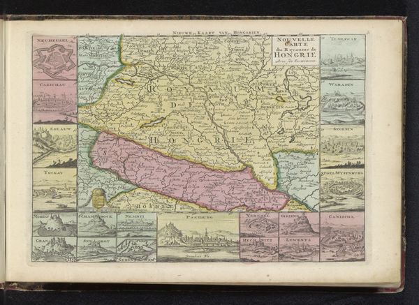
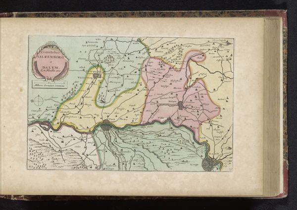
Dimensions: height 178 mm, width 264 mm
Copyright: Rijks Museum: Open Domain
This is an anonymous map of Transylvania, also known as Zevenburgen, made using engraving. Maps are never neutral; they are cultural artifacts shaped by the power dynamics of their time. In a region as historically contested as Transylvania, this map serves as a political document, staking a claim to territory and identity. The detailed insets depicting cities and landscapes aren't just geographical markers, they are symbols of cultural pride and dominance. Consider how the act of mapping itself—deciding what to include and what to omit—reflects the mapmaker's, or their patron's, agenda. The choice of language, the depiction of settlements, the boundaries drawn, all tell a story about who belongs and who is excluded. This map invites us to reflect on the human desire to define and control space, and the impact this has on the lives of those who inhabit it.
Comments
No comments
Be the first to comment and join the conversation on the ultimate creative platform.