print, engraving
#
baroque
#
dutch-golden-age
# print
#
linocut print
#
geometric
#
engraving
#
realism
Dimensions: height 502 mm, width 580 mm
Copyright: Rijks Museum: Open Domain
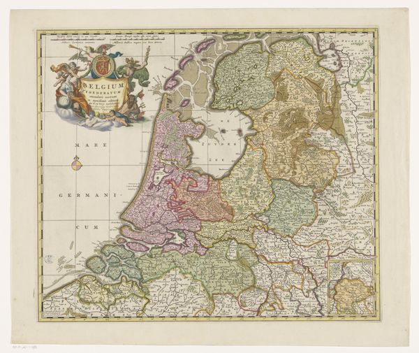
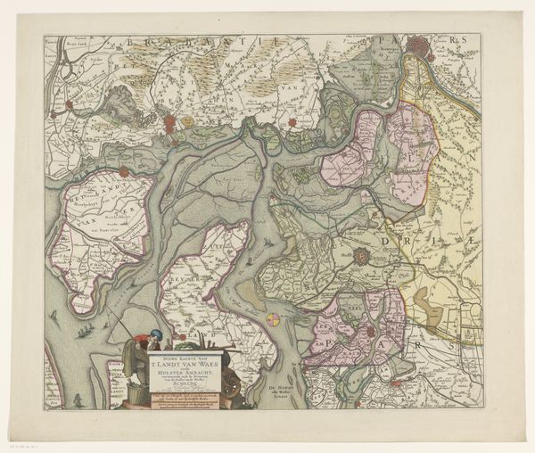
Curator: This print, titled "Kaart van Holland, Utrecht en een deel van Gelderland", provides a detailed map of the Netherlands, dating from the period 1741 to 1748. Editor: It feels almost like an abstract painting from a distance! The delicate lines create these fascinating geometric shapes; a playful arrangement of colors and textures that captures my eye. Curator: Indeed, it's more than just a factual depiction; it also serves as a symbol of the wealth of resources in Holland during that period. Each line meticulously engraved representing territory. The print uses both Baroque and realism. We see precise engraving work in the province borders that are also stylized in baroque decoration. Editor: And all that detail, think about the hands that made it! To imagine an artisan meticulously etching each line brings this image alive. I can almost smell the ink and the paper. Does the coloring signify resource distribution? Curator: Not exactly, but it represents regional jurisdiction, delineating the territories of Holland, Utrecht, and Gelderland. The colors were applied after the engraving process. Consider the use of paper too: where was the paper sourced, how was it treated to ensure the ink was well received? It speaks of trading routes and technological production that facilitated its creation. Editor: Fascinating! To think each little town was a bustling hub with trades, beliefs and dramas happening on this stage we're overlooking in its entirety. Each of us is a tiny actor on a giant geometric play-board! Curator: Precisely, and each map is itself a product of its time. In our contemporary lens, its style is fascinating but we often undermine that this type of image was key to facilitating trade, documenting property. Editor: So true, what feels decorative to us today was entirely utilitarian at the time. Looking at it that way enhances appreciation, in a sense! The geometric harmony has some hidden utilitarian significance we'll never truly know. Curator: Well put. The interplay of its purpose, production, and the visual result create its enduring attraction, that's precisely the point! Editor: A satisfying insight. Thanks to these layers of intention it transcends its geography to touch some playful existential chords in me.
Comments
No comments
Be the first to comment and join the conversation on the ultimate creative platform.
More like this