drawing, print, paper, watercolor
#
drawing
#
water colours
# print
#
landscape
#
paper
#
11_renaissance
#
watercolor
#
ancient-mediterranean
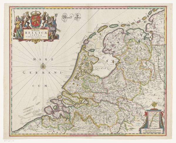
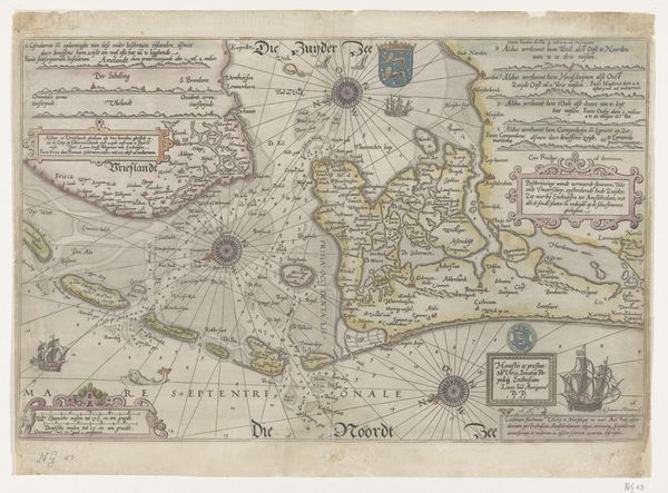
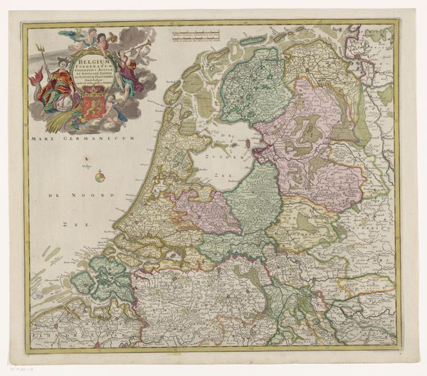
Dimensions: height 375 mm, width 489 mm
Copyright: Rijks Museum: Open Domain
Editor: This print, "Historische kaart van de Nederlanden," from 1584… It's like a beautiful, ancient tapestry, charting a world far removed from our own GPS-led existences. I'm struck by how different this feels from modern maps, almost more like a story being told. What do you see in this piece, beyond just the geographical details? Curator: Ah, a story indeed! It’s a beautiful object, isn’t it? Maps of this era are fascinating because they straddle the line between scientific document and artistic expression. The perspective isn't quite what we're used to, is it? It’s less about accurate representation and more about conveying a sense of place, of the bounty and significance of the region. It is kind of like a family album of a country. Now, what jumps out to you first - aside from the unfamiliar layout? Is it the fauna? Editor: Probably the decoration; the elaborate cartouches feel less about information and more like a painter adding flair. And what is the symbolism behind them? Curator: Exactly! Think of these as visual annotations - and that's what makes them valuable today. They offer clues into how the people understood their place in the world. This was during a period of intense political and religious turmoil – it’s probable this map offered viewers of the time not only a representation of geography, but a source of comfort in seeing their territory laid out before them, understood. I think it's worth asking what this map tells us that satellite images can't. Editor: It’s less sterile, more human. The imperfections offer a perspective. Curator: Beautifully said. A lovely thought to sit with, isn’t it?
Comments
No comments
Be the first to comment and join the conversation on the ultimate creative platform.
More like this