print, engraving
#
dutch-golden-age
# print
#
landscape
#
linocut print
#
geometric
#
cityscape
#
engraving
Dimensions: height 407 mm, width 297 mm
Copyright: Rijks Museum: Open Domain
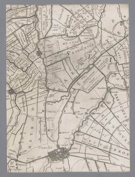
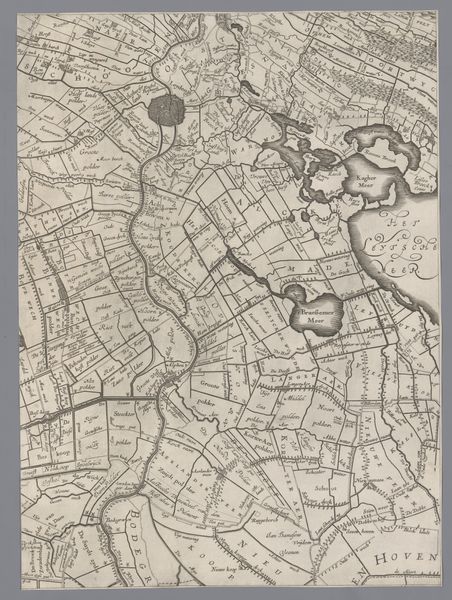
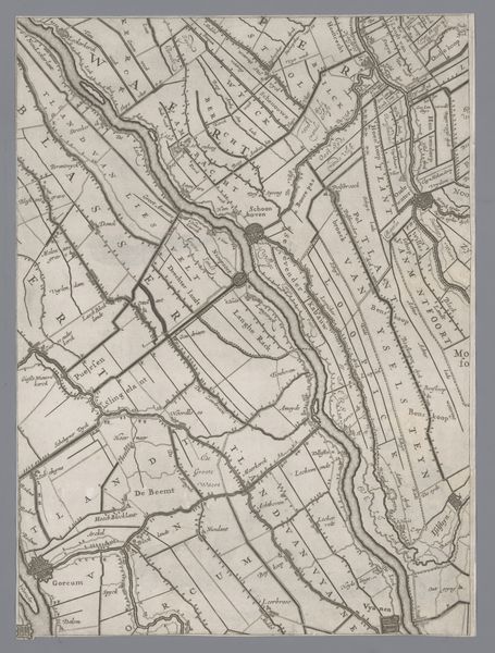
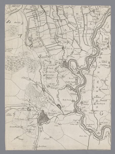
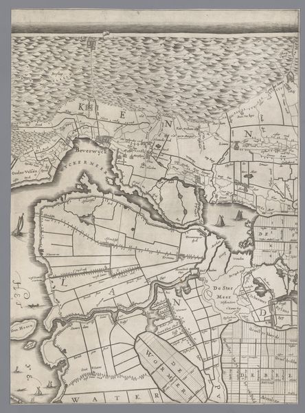
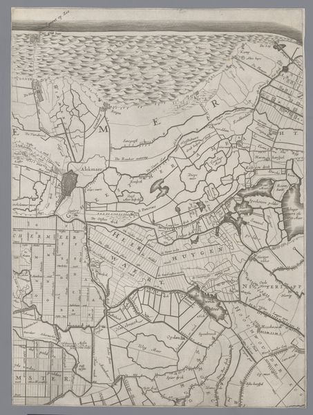
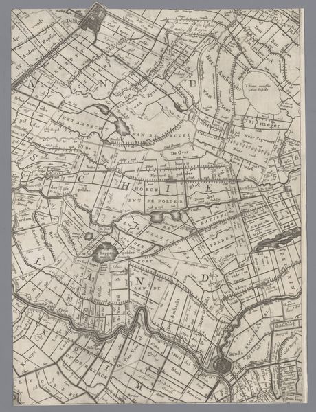
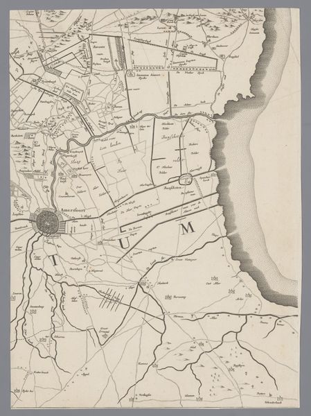
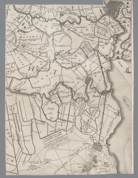
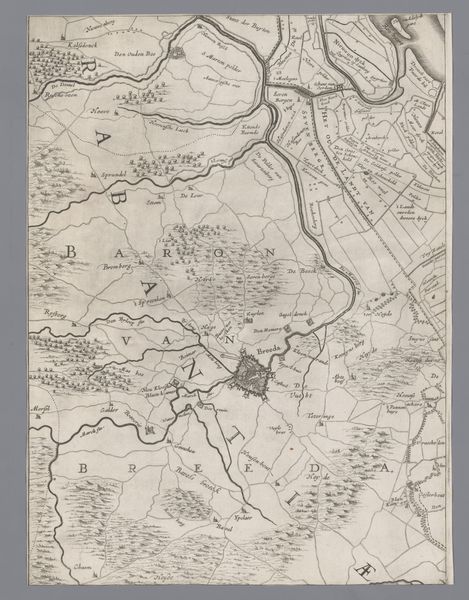
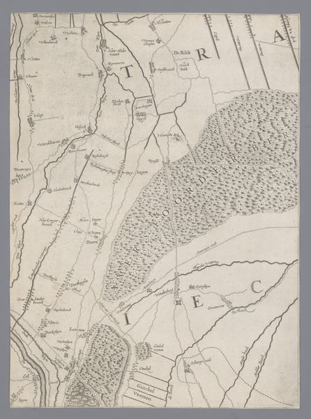
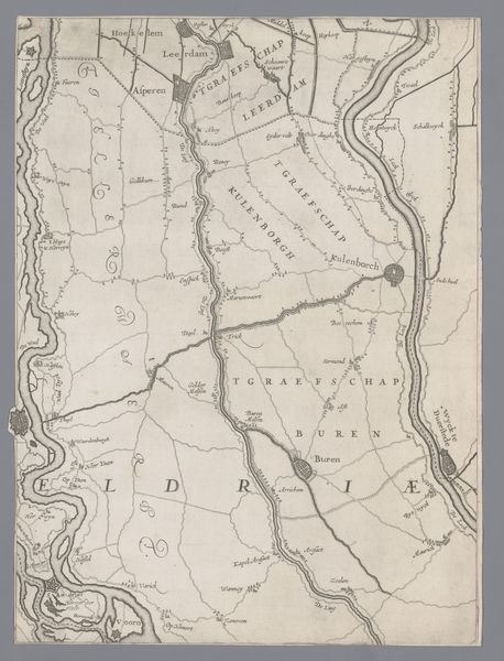
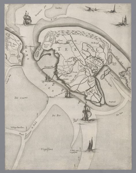
Curator: This engraving, produced in 1639 by Jacob Aertsz. Colom, depicts a detailed map titled "Kaart van het Graafschap Holland en Utrecht," illustrating the counties of Holland and Utrecht. Editor: Immediately, the sheer density of information strikes me; every square inch appears meticulously inscribed. The shades create almost an aquatic feeling, reminiscent of looking at sediment and shallows in an old seabed. Curator: Indeed, the engraving technique allows for such incredible detail. Notice the geometric precision in partitioning the land, indicating plots and territories, as well as the use of linework to define topological formations and waterways. How might this representation inform our understanding of Dutch Golden Age cartography? Editor: I find myself considering the material reality behind this print. Think of the skilled artisan meticulously carving these lines into the plate, each stroke deliberate and shaping our perception of this space. Also, given the burgeoning mercantile activity of this period, cartography was essential. This was functional art, intimately linked to economics and power. Curator: Precisely. Semiotically, the map functions as more than a geographical document; it operates as an assertion of control and knowledge. Each labelled area implies a system of ownership and governance rendered tangible through visual representation. Editor: I agree; beyond the semiotics of control, there’s also the labor aspect. Creating this level of intricacy was labor-intensive, possibly collaborative with varied specialized tasks. Understanding the workshops producing these prints tells us a great deal about the economic underpinnings of the Golden Age. Curator: A compelling point about the collaborative context. Shifting focus back to aesthetics, observe the consistent visual language utilized; it’s an example of a harmonious structure reflecting established cartographic principles of the time. The formal qualities contribute directly to its functional efficiency as a map. Editor: Ultimately, what’s captivating here is how a seemingly technical object – a map – illuminates the relationship between labor, landscape, and social control. This isn't just a picture of land; it’s a picture of the systems used to manage it. Curator: An astute observation, offering a rich perspective on how material conditions are embedded within representational forms. Editor: Indeed; a valuable confluence of precision and purposeful making.
Comments
No comments
Be the first to comment and join the conversation on the ultimate creative platform.
More like this