graphic-art, print, engraving
#
graphic-art
#
dutch-golden-age
# print
#
landscape
#
cityscape
#
engraving
Dimensions: height 405 mm, width 295 mm
Copyright: Rijks Museum: Open Domain
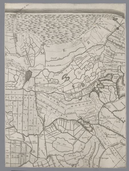
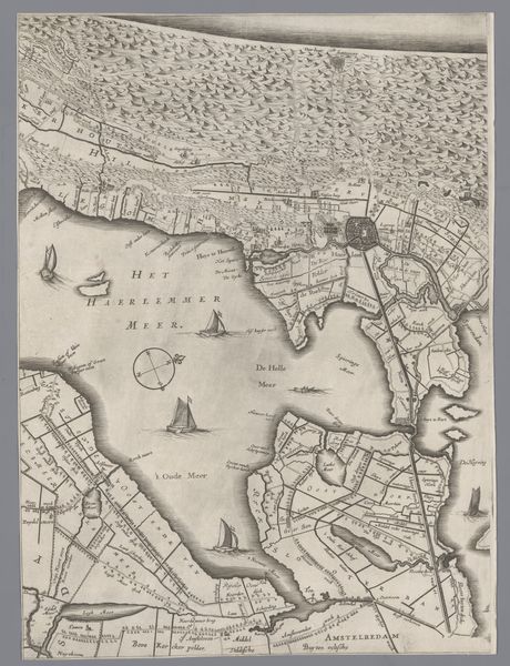
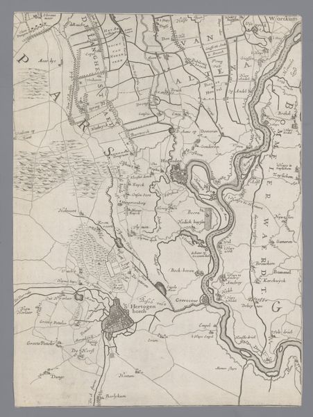
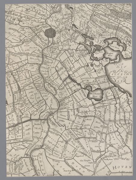
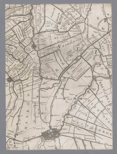
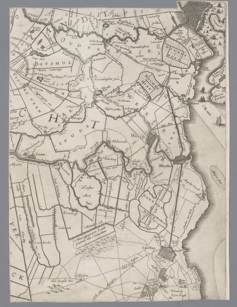
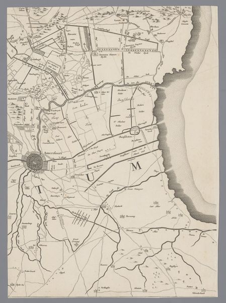
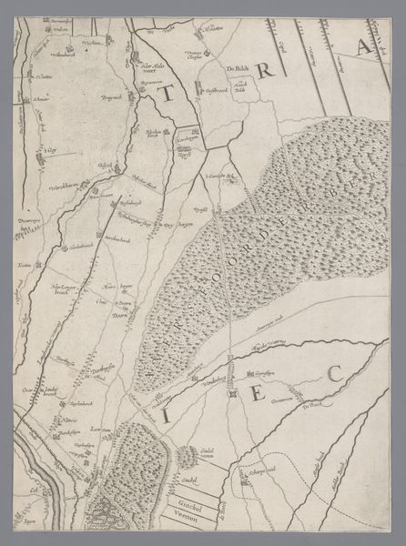
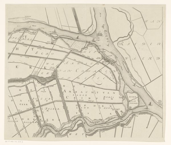
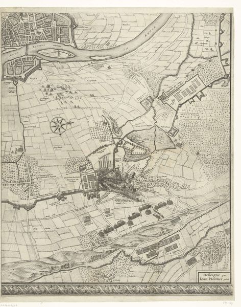
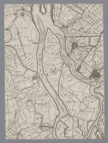
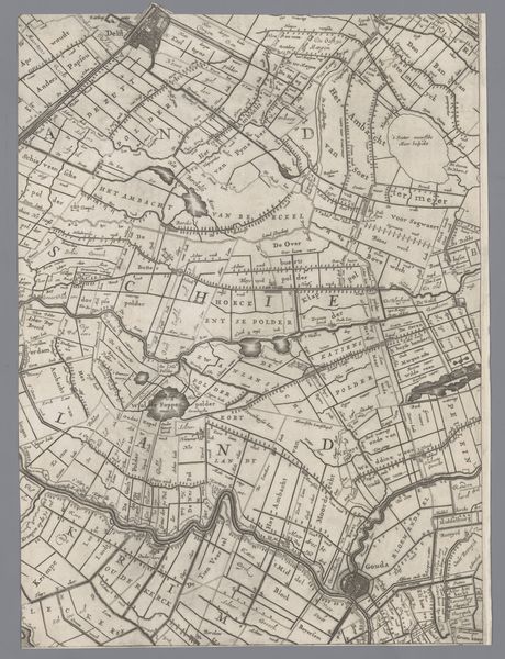
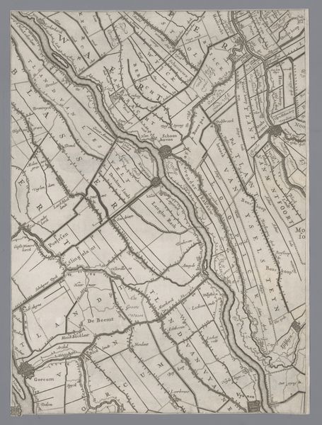
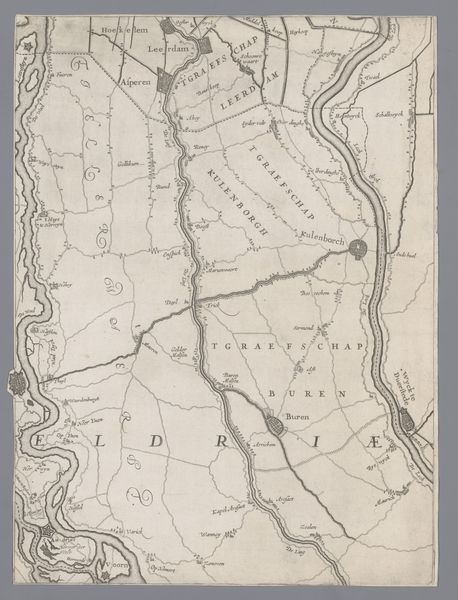
Curator: Here we have "Kaart van het Graafschap Holland en Utrecht," plate 16, made by Jacob Aertsz Colom in 1639. It's a meticulously detailed engraving depicting the counties of Holland and Utrecht during the Dutch Golden Age, part of the Rijksmuseum's collection. What are your first impressions? Editor: Woah, that's a crazy amount of detail. Like staring into an ant farm, except instead of ants, there are perfectly lined-up fields and waterways. Seriously, my brain is trying to decide if it's a map or an abstract pattern. A landscape reduced to its bare, utilitarian bones! Curator: The precision speaks to the period’s emphasis on cartography and land management. Mapping was integral to trade, defense, and, perhaps most significantly, the aggressive land reclamation projects that shaped the very geography of the Netherlands. It reflects an ambition to control their environment and codify their territory. Editor: You're absolutely right, there's a real assertion of dominion here! It is interesting how little it reveals of human existence though; these neat lines don't tell a single thing about individual lives, hopes or fears. Do you think the intention was more symbolic or practical? Curator: I’d say both, intrinsically linked! Mapping in the 17th century functioned as a powerful visual tool, legitimizing state power and reinforcing territorial claims amidst a competitive landscape. The detailed waterways shown weren't only shipping routes but represented critical infrastructures that drove commerce. So it becomes very difficult to separate functionality from symbolism at this time. Editor: It really speaks of the age, the Dutch Golden Age as the epitome of structured organization, wealth and sea exploration. All that distilled in one picture. The sea reminds me of an almost scientific study, as the depiction of the waves contrasts so much with the rigid straight lines dominating the land. What strikes you the most? Curator: It’s the historical shift in our relationship to the environment that really captivates me. These kinds of maps represent a crucial step towards a systemic exploitation of the land that has been so heavily debated, but also advanced. Editor: You make a great point. Well, thinking of it like that, I won’t see land reclamation quite the same way again.
Comments
No comments
Be the first to comment and join the conversation on the ultimate creative platform.
More like this