graphic-art, print, engraving
#
graphic-art
#
dutch-golden-age
# print
#
landscape
#
linocut print
#
geometric
#
engraving
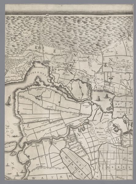
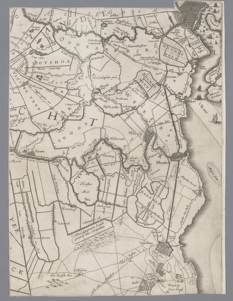
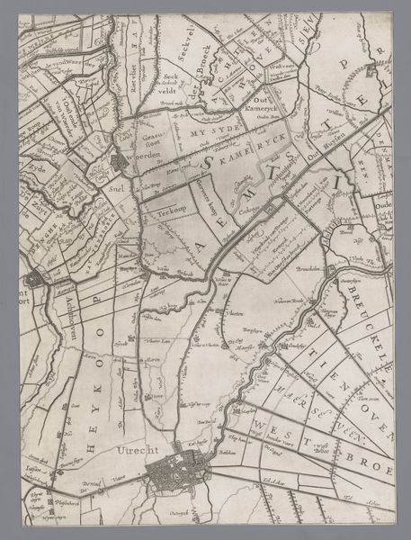
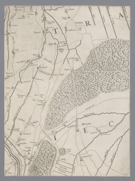
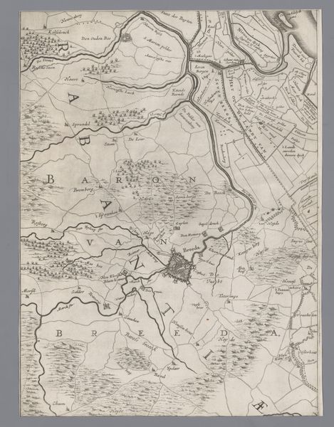
Dimensions: height 408 mm, width 300 mm
Copyright: Rijks Museum: Open Domain
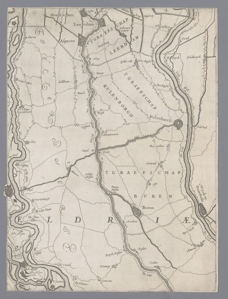
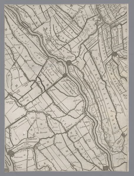
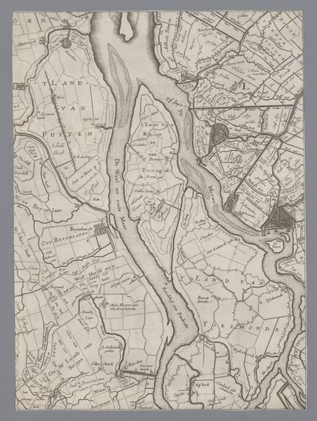
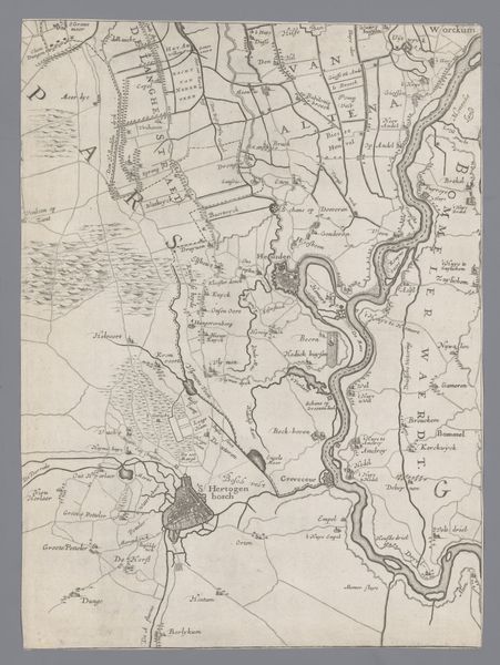
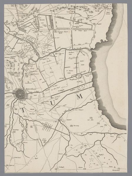
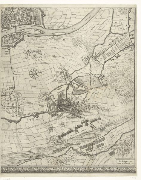
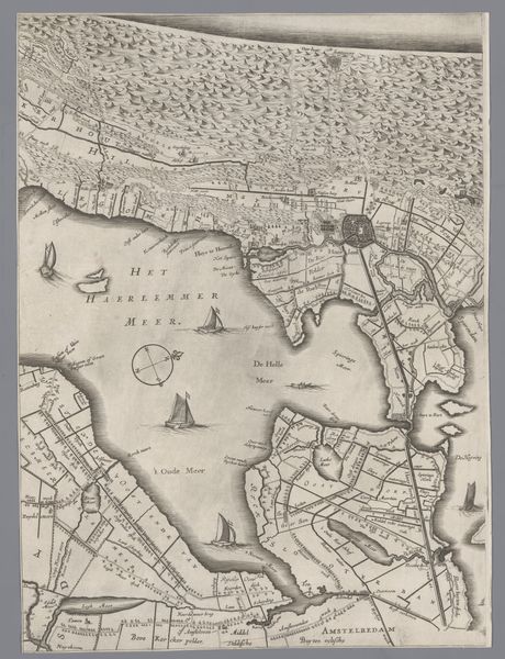
Curator: This detailed map is "Kaart van het Graafschap Holland en Utrecht" (plate 17) created in 1639 by Jacob Aertsz. (I) Colom. Editor: At first glance, I'm struck by the map's incredible intricacy. The level of detail creates almost a visual tapestry effect; the densely packed lines and varied textures remind me of looking at land through an airplane window. Curator: Absolutely. Cartography during the Dutch Golden Age wasn't merely about navigation; these maps projected power and knowledge. We see a careful arrangement of space reflecting socio-political divisions of the era, particularly among regional water authorities. It offers clues on land ownership and power dynamics related to control of resources. Editor: Indeed. Looking closer, I notice the strategic positioning of certain symbols. What do you make of the prevalence of geometric shapes? The fields divided into rigid grid-like sections suggest a very structured relationship between the Dutch people and their land. This resonates on a symbolic level, perhaps a yearning for control, a defining characteristic of this culture at that moment. Curator: Yes, and it's important to understand how these maps simultaneously documented and shaped the landscape. Major waterways dictated trade routes and access. This specific engraving visualizes concepts of property, but who was it designed for? Certainly a more affluent male audience interested in colonial affairs. The story told within the cartography highlights the cultural impact on communities excluded from those in power, women in particular, which offers important contemporary resonance. Editor: I agree. And even though it's monochrome, the variation in line thickness lends depth, creating the illusion of physical terrain. The artist is using specific, almost encoded systems of communication that tell much bigger and powerful stories. As with many artifacts, at its surface we observe geometry, lines and geographic details, yet it reflects deeper aspects of 17th-century Dutch society that are worth contemplating and continue to affect current global issues. Curator: These cartographic techniques speak volumes about identity, geography, history, commerce, power. They still reverberate. Thank you. Editor: Indeed.
Comments
No comments
Be the first to comment and join the conversation on the ultimate creative platform.
More like this