print, engraving
# print
#
landscape
#
geometric
#
history-painting
#
academic-art
#
engraving
Dimensions: height 342 mm, width 395 mm
Copyright: Rijks Museum: Open Domain
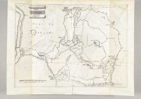
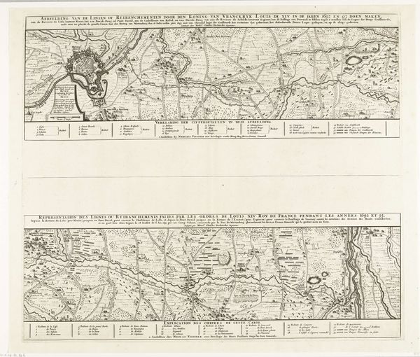
This is T.Z. Keikes’ map of troop positions at Quatre-Bras, made in 1815. It offers us a glimpse into the immediate aftermath of the Battle of Quatre Bras, a precursor to Waterloo, which reshaped the map of Europe and impacted the political and social landscapes of numerous nations. Maps like these were not neutral documents; they were tools of power, influencing public perception of military events. The careful detailing of troop placements and terrain served a dual purpose: to inform military strategy and to shape a narrative of control and order amidst the chaos of war. Consider how cartography intersects with identity. The map represents a very specific, top-down view of a conflict, often erasing the experiences of ordinary soldiers and civilians. Who is included, and whose stories are left out? It invites us to reflect on the human cost of these strategic representations. Looking at this map, think about the stories it tells and the silences it holds.
Comments
No comments
Be the first to comment and join the conversation on the ultimate creative platform.
More like this