drawing, print, paper, ink, pen, engraving
#
drawing
#
aged paper
#
toned paper
#
baroque
# print
#
pen sketch
#
landscape
#
paper
#
personal sketchbook
#
ink
#
ink drawing experimentation
#
pen-ink sketch
#
pen work
#
sketchbook drawing
#
pen
#
storyboard and sketchbook work
#
sketchbook art
#
engraving
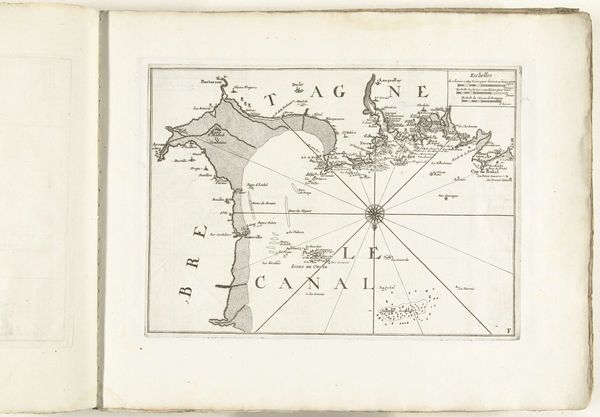
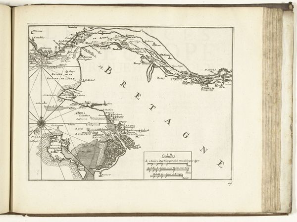
Dimensions: height 331 mm, width 180 mm
Copyright: Rijks Museum: Open Domain
Editor: This is a map titled "Kaart van de westkust van Galicië, 1726", created in 1726 by an anonymous artist. It's a pen and ink drawing on paper. What immediately strikes me is how it reduces a vast and complex landscape into such a neat, bounded, almost geometric form. How do you interpret the significance of such depictions in their historical context? Curator: Well, considering its date, it's crucial to see this map not just as a geographical representation, but also as a tool of power. Maps like this were instrumental for colonial ambitions and trade control. Galicië, with its access to the Atlantic, held strategic importance. So, how do you think the act of mapping itself, and the choices the mapmaker makes, become a statement of control? Editor: I suppose reducing it to lines and points gives the impression that it's something easily understood and managed. But doesn’t it also, in its detail, hint at a deeper, more complex reality that resists such simplification? Curator: Precisely! It's a paradox. The act of defining borders, naming locations, it's all a way to claim ownership, even psychologically. The radiating lines emanating from the center… what could they represent in this context? Editor: Maybe lines of navigation or influence? It's interesting to think about how something that looks so objective is actually loaded with political and cultural meaning. I never considered maps as being so explicitly tied to power. Curator: Indeed, the history of cartography is deeply entwined with the history of empire-building. Considering the Rijksmuseum's role in showcasing colonial history, this map reminds us to critically examine whose perspectives are represented, and whose are erased, in visual representations of space and place. It is also very rare, it appears as personal exploration in ink in a sketchbook, maybe preceding something more impactful in the world of maritime trade. Editor: That really changes how I see this piece, it's much more than just a simple drawing of a coastline. Thank you for shedding a light!
Comments
No comments
Be the first to comment and join the conversation on the ultimate creative platform.
More like this