print, engraving
# print
#
landscape
#
line
#
engraving
Dimensions: height 226 mm, width 298 mm
Copyright: Rijks Museum: Open Domain
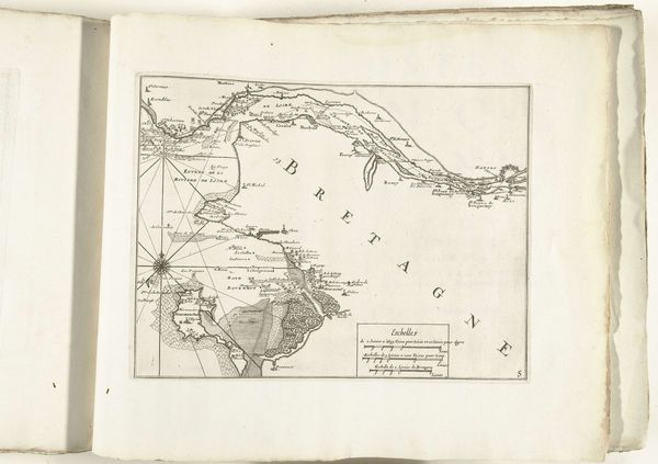
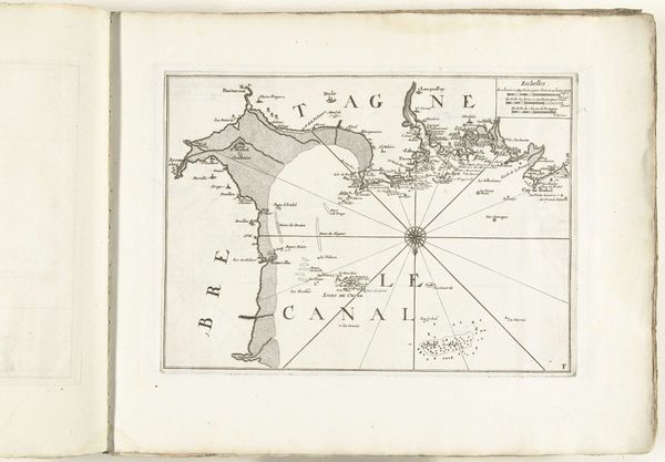
This map of the south coast of Brittany near Nantes was made in 1726, using printmaking techniques. It’s ink on paper, but the real story is in the making. Look closely, and you'll see the lines are precise, the lettering neat. This wasn't drawn freehand; it was etched into a metal plate, probably copper, using acid to bite away the unprotected areas. The plate would then be inked, and the paper pressed against it. Consider the skills involved: the engraver's steady hand, the knowledge of chemistry to control the etching, and the printing press operator's expertise. Each impression required labor, a whole chain of it. Maps like this weren't just about geography; they were about power, trade, and control. They guided ships, charted resources, and laid claim to territory. Next time you see a map, remember it’s more than just lines on paper; it’s a record of human effort, ambition, and the intricate dance between art, craft, and commerce.
Comments
No comments
Be the first to comment and join the conversation on the ultimate creative platform.
More like this