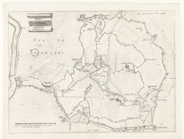
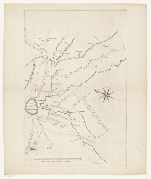
Omsingeling van Den Bosch tijdens het beleg door Frederik Hendrik, 1629 1629 - 1631
0:00
0:00
anonymous
Rijksmuseum
print, engraving
#
baroque
# print
#
cityscape
#
engraving
Dimensions: height 360 mm, width 493 mm
Copyright: Rijks Museum: Open Domain
This is an anonymous rendering of the Siege of Den Bosch by Frederik Hendrik in 1629. It’s a detailed map, made during a pivotal moment in the Eighty Years' War, a conflict deeply rooted in religious and political tensions. Maps like these were strategic tools, weren't they? They were more than just geographical representations; they were instruments of power, defining territories, and charting military campaigns. They were defining the boundaries of identity, both for the Dutch Republic and its adversaries. Consider how the act of mapping itself is an assertion of control, claiming space and imposing a particular perspective. This map isn’t a neutral document; it embodies the aspirations and biases of its creators and patrons. What does it mean to survey, to encircle, to lay siege? This map lays bare the strategies of war, revealing a landscape not just of geography, but of human conflict and ambition.
Comments
No comments
Be the first to comment and join the conversation on the ultimate creative platform.
More like this