About this artwork
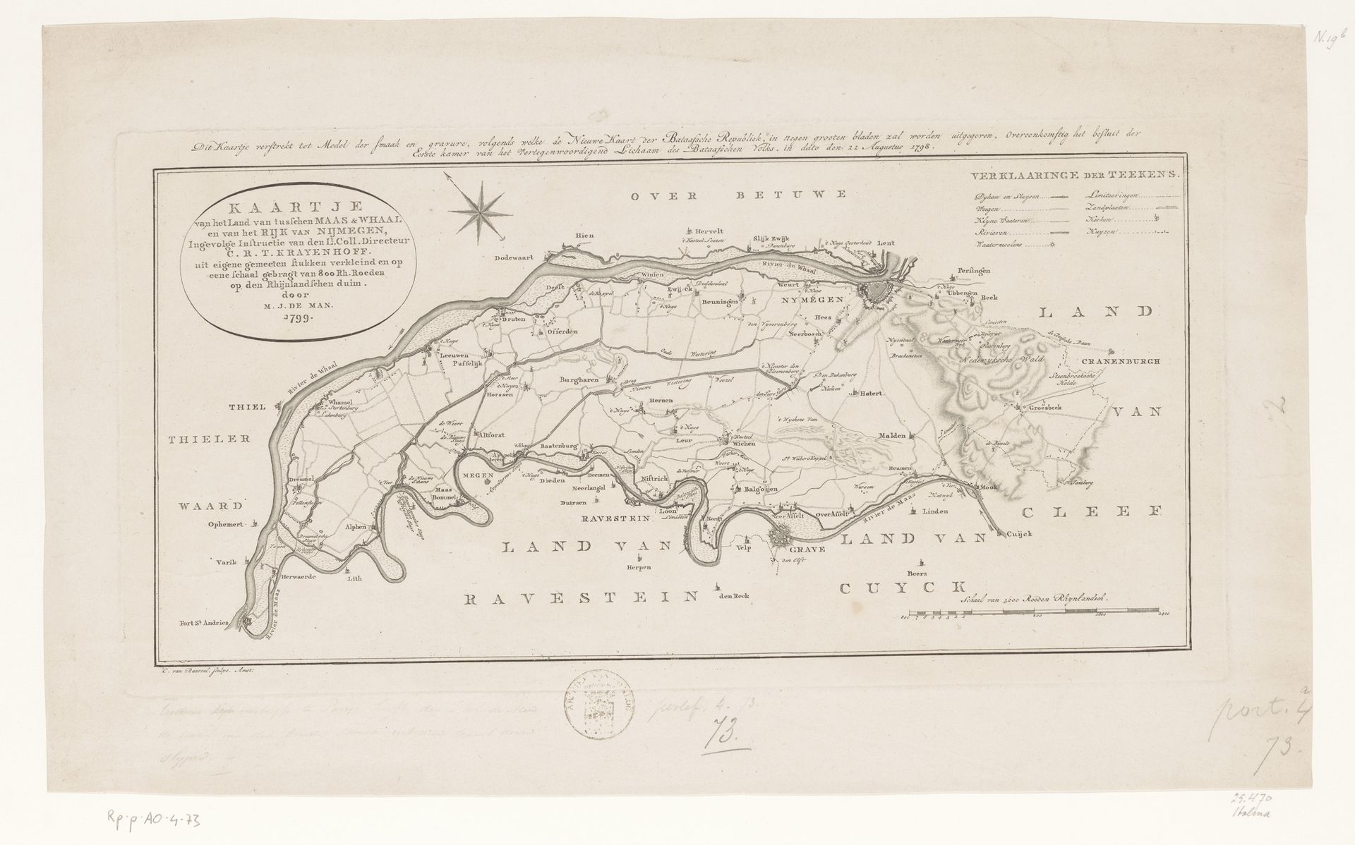
Editor: Here we have "Kaart van het land tussen de Maas en de Waal," a map created in 1799 by Cornelis van Baarsel. It’s an engraving, rendered with such precision! There's something incredibly captivating about seeing land represented this way. What historical context really shaped this particular map's creation and intended use? Curator: That’s a great question. Looking at this map, we have to remember it's not just about geography, it's about power, and even propaganda. Maps in the late 18th century were crucial tools for nation-building, especially in politically fragmented regions. Think about it: who was commissioning these maps and what were their goals? Were they intended for military use, administrative planning, or even public consumption? The detail emphasizes a specific vision of the region and what the mapmaker wants the viewer to see as important. Editor: So, it’s less a neutral record and more a...statement? You can tell the perspective of the people making it? Curator: Exactly. It subtly promotes particular agendas by emphasizing specific areas. A dense road system versus one or two buildings indicates how much control these cities hold over society. Did these elements of design reflect how Baarsel chose to show who held the real authority over society? Editor: That’s fascinating! I always thought of maps as objective. But now I see how they could be instruments, too. So understanding who funded and controlled their distribution, shapes their intent! Curator: Precisely. Considering how these images were circulated can tell us about broader political shifts within society during this period. So the next time you look at a historical map, think about what stories it might be trying to tell beyond simply ‘where’ things are. Editor: Thanks for shedding light on the importance of this graphic; I feel much more capable now when viewing artwork of similar context. Curator: Anytime; this was a pleasure.
Artwork details
- Medium
- drawing, graphic-art, print, ink, engraving
- Dimensions
- height 230 mm, width 448 mm
- Copyright
- Rijks Museum: Open Domain
Tags
Comments
Share your thoughts
About this artwork
Editor: Here we have "Kaart van het land tussen de Maas en de Waal," a map created in 1799 by Cornelis van Baarsel. It’s an engraving, rendered with such precision! There's something incredibly captivating about seeing land represented this way. What historical context really shaped this particular map's creation and intended use? Curator: That’s a great question. Looking at this map, we have to remember it's not just about geography, it's about power, and even propaganda. Maps in the late 18th century were crucial tools for nation-building, especially in politically fragmented regions. Think about it: who was commissioning these maps and what were their goals? Were they intended for military use, administrative planning, or even public consumption? The detail emphasizes a specific vision of the region and what the mapmaker wants the viewer to see as important. Editor: So, it’s less a neutral record and more a...statement? You can tell the perspective of the people making it? Curator: Exactly. It subtly promotes particular agendas by emphasizing specific areas. A dense road system versus one or two buildings indicates how much control these cities hold over society. Did these elements of design reflect how Baarsel chose to show who held the real authority over society? Editor: That’s fascinating! I always thought of maps as objective. But now I see how they could be instruments, too. So understanding who funded and controlled their distribution, shapes their intent! Curator: Precisely. Considering how these images were circulated can tell us about broader political shifts within society during this period. So the next time you look at a historical map, think about what stories it might be trying to tell beyond simply ‘where’ things are. Editor: Thanks for shedding light on the importance of this graphic; I feel much more capable now when viewing artwork of similar context. Curator: Anytime; this was a pleasure.
Comments
Share your thoughts