print, engraving
# print
#
old engraving style
#
landscape
#
geometric
#
engraving
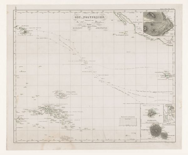
Dimensions: height 215 mm, width 345 mm
Copyright: Rijks Museum: Open Domain
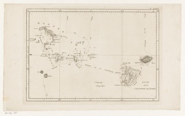
This undated map of the Tonga Archipelago, or the Friendly Islands as it was known, is rendered in ink. The drawing is characterized by delicate lines and a muted palette, evokes a sense of both scientific precision and aesthetic refinement. The composition is structured around a grid of latitude and longitude lines, which serve to organize the islands within a broader geographical context. The islands themselves are depicted as clusters of detailed shapes, their contours traced with meticulous care. Note how the use of shading creates a sense of depth and volume, giving the islands a tactile quality. The map's formal elegance belies its complex engagement with themes of exploration, colonialism, and cross-cultural encounter. The act of mapping, after all, is an act of claiming space. Here, the map challenges fixed notions of territory and representation, prompting us to consider the power dynamics inherent in the European encounter with the Pacific world. The formal aspects of this map invite us to consider its role within broader historical and cultural narratives.
Comments
No comments
Be the first to comment and join the conversation on the ultimate creative platform.
More like this