About this artwork
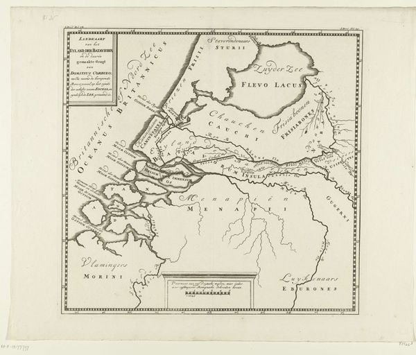
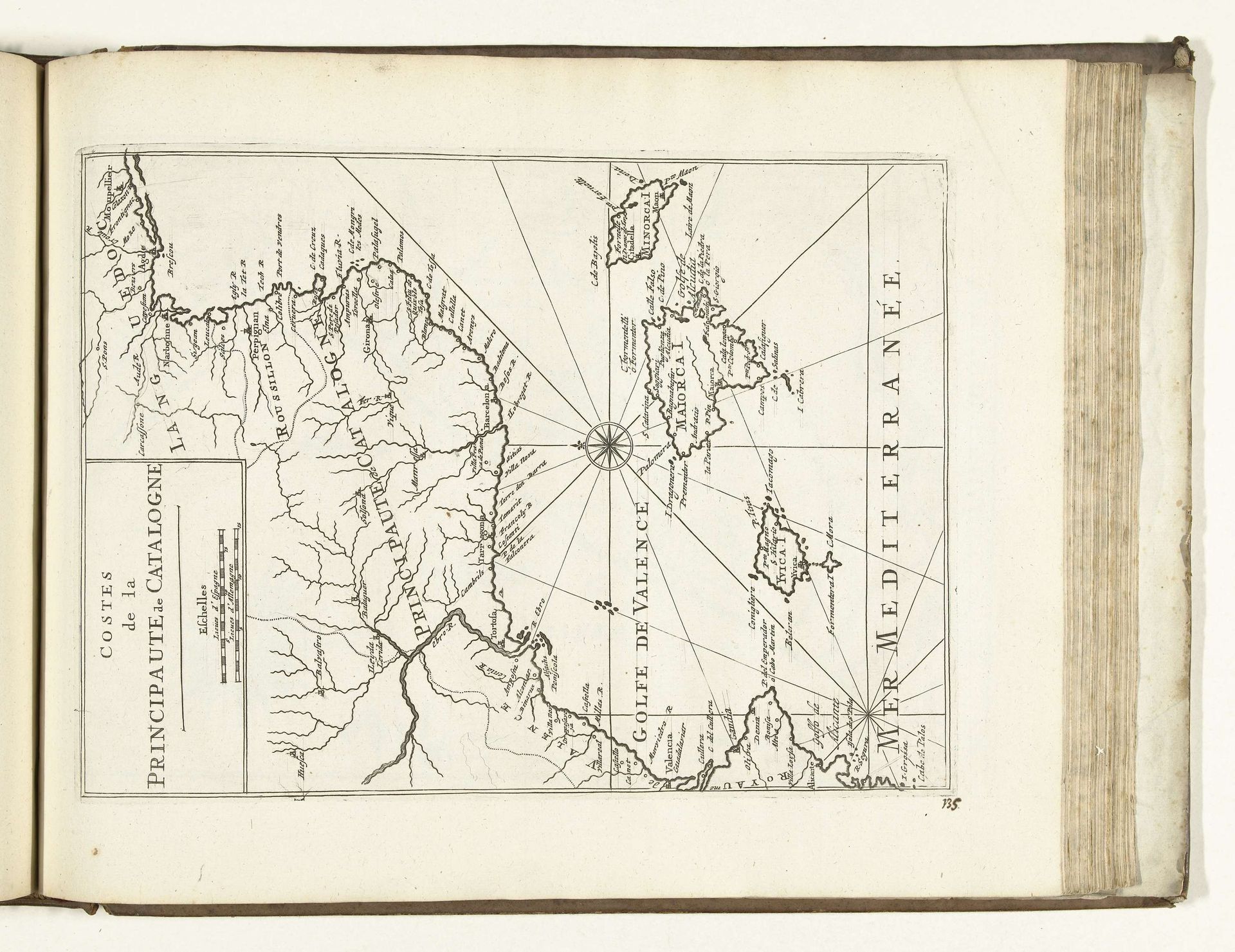
Curator: Editor: Let's consider this intriguing "Kaart van de Catalaanse kust, 1726," a drawing made with ink and engraving, currently held in the Rijksmuseum. Looking at the image, I am immediately struck by the cartographer’s careful detailing of the coastline, despite the limitations of the era. How should we interpret such an archaic view, from a cultural studies standpoint? Curator: Exactly. Maps, particularly historical ones like this, are rarely neutral. Consider the context: 1726. What stories does this map suppress or promote regarding power structures? What does it tell us about colonial desires? Editor: You're right, I hadn't considered the power dynamics involved in its creation and subsequent use. It presents a very Eurocentric perspective. The detailing of the Catalan coast and surrounding areas, which perhaps implies importance to those commissioning or using the map. Does the precision signify anything beyond geographical accuracy? Curator: The act of mapping itself is an assertion of dominance, it imposes a certain worldview. Who has the power to name and define? Note, for example, the language used. How does the language reinforce coloniality? The use of specific place names also solidifies control and legitimizes territorial claims. This connects directly to our conversations about the politics of representation. The Catalan coast, a key location for trade routes. Therefore it becomes necessary to meticulously survey for colonial expansion and wealth extraction, which profoundly affected the communities residing along the coast. What are your reflections now? Editor: Thinking about the map in that light, I understand the importance of not seeing this image simply as a neutral tool. This artwork allows me to think deeper, realizing its reflection of social dynamics inherent in geographic exploration during this period. Thank you, it changed my whole viewpoint! Curator: And likewise! This discussion underlines why critically examining historical artworks through a contemporary, intersectional lens matters so much. We have to see them as products of their time, yet consider them critically for their lasting influence in a broader political discourse.
Artwork details
- Medium
- drawing, ink, engraving
- Dimensions
- height 313 mm, width 228 mm
- Location
- Rijksmuseum
- Copyright
- Rijks Museum: Open Domain
Tags
Comments
Share your thoughts
About this artwork
Curator: Editor: Let's consider this intriguing "Kaart van de Catalaanse kust, 1726," a drawing made with ink and engraving, currently held in the Rijksmuseum. Looking at the image, I am immediately struck by the cartographer’s careful detailing of the coastline, despite the limitations of the era. How should we interpret such an archaic view, from a cultural studies standpoint? Curator: Exactly. Maps, particularly historical ones like this, are rarely neutral. Consider the context: 1726. What stories does this map suppress or promote regarding power structures? What does it tell us about colonial desires? Editor: You're right, I hadn't considered the power dynamics involved in its creation and subsequent use. It presents a very Eurocentric perspective. The detailing of the Catalan coast and surrounding areas, which perhaps implies importance to those commissioning or using the map. Does the precision signify anything beyond geographical accuracy? Curator: The act of mapping itself is an assertion of dominance, it imposes a certain worldview. Who has the power to name and define? Note, for example, the language used. How does the language reinforce coloniality? The use of specific place names also solidifies control and legitimizes territorial claims. This connects directly to our conversations about the politics of representation. The Catalan coast, a key location for trade routes. Therefore it becomes necessary to meticulously survey for colonial expansion and wealth extraction, which profoundly affected the communities residing along the coast. What are your reflections now? Editor: Thinking about the map in that light, I understand the importance of not seeing this image simply as a neutral tool. This artwork allows me to think deeper, realizing its reflection of social dynamics inherent in geographic exploration during this period. Thank you, it changed my whole viewpoint! Curator: And likewise! This discussion underlines why critically examining historical artworks through a contemporary, intersectional lens matters so much. We have to see them as products of their time, yet consider them critically for their lasting influence in a broader political discourse.
Comments
Share your thoughts