graphic-art, print, engraving
#
graphic-art
# print
#
landscape
#
engraving
#
realism
Dimensions: height 165 mm, width 225 mm
Copyright: Rijks Museum: Open Domain
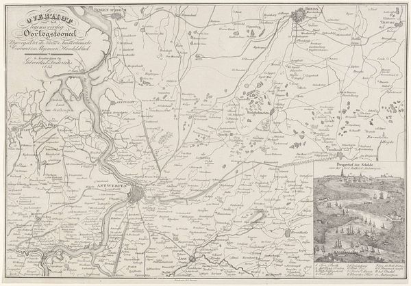
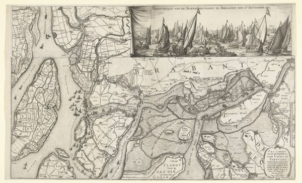
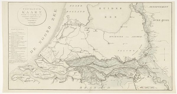
This map of the Schelde estuary was made in 1809, by Ramboz, using etching, a printmaking process, on paper. Look closely, and you can see how the lines have been incised into a metal plate, probably copper, and then printed. The act of creating the map is itself a way of taking possession of it. The precise lines are not just descriptive; they are performative. This isn't just any map, it is a military map, designed for strategic purposes, produced through specialized labor. Consider the social context of this map. It would have been critical to the ambitions of Napoleon, giving him command over territory and trade routes. The clean lines and precise details are a testament to the Enlightenment values of reason and control, even as they were being deployed for purposes of conquest. By considering the materials and processes, the making of the map becomes as significant as the places it depicts. The value lies not just in its representation, but in its making.
Comments
No comments
Be the first to comment and join the conversation on the ultimate creative platform.
More like this