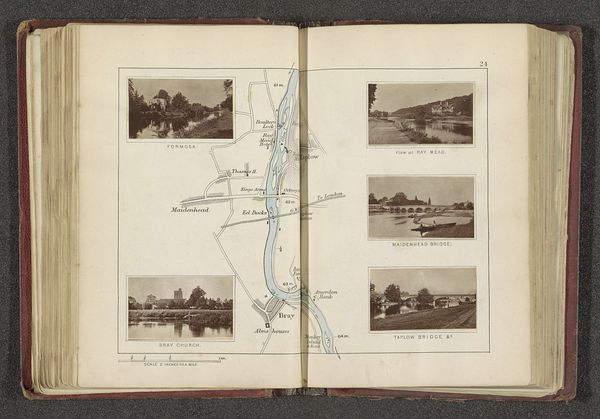
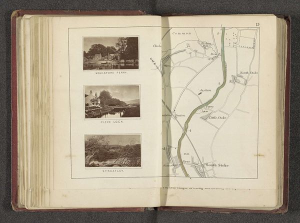
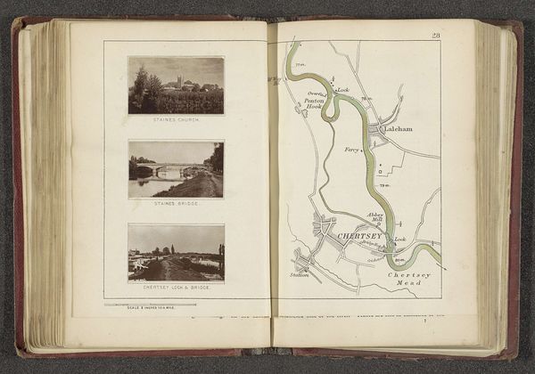
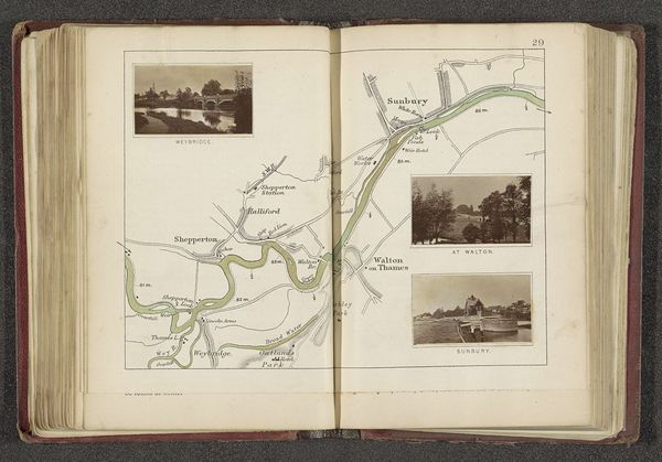
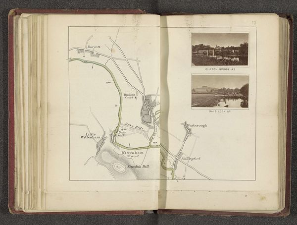
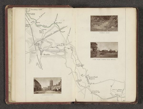
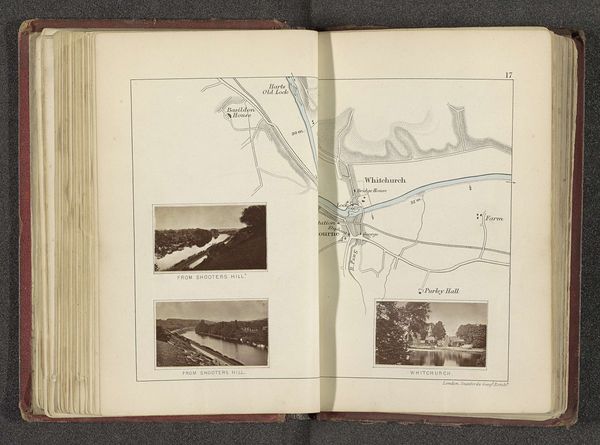
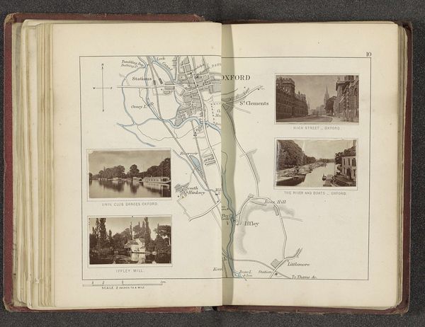
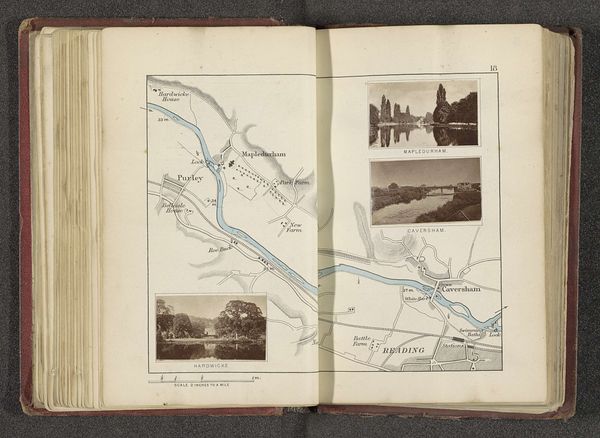
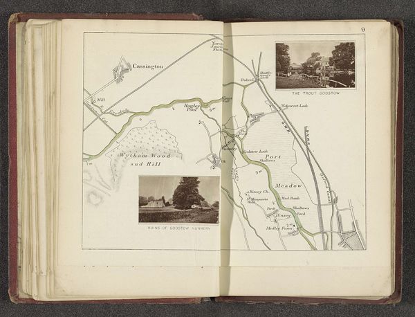
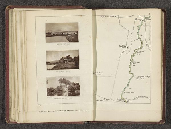
Kaart met vier afbeeldingen van plaatsen langs de Theems bij Henley-on-Thames before 1879
0:00
0:00
print, paper, photography
# print
#
landscape
#
river
#
paper
#
photography
#
coloured pencil
#
cityscape
Dimensions: height 164 mm, width 227 mm
Copyright: Rijks Museum: Open Domain
Curator: This is an intriguing visual record titled "Kaart met vier afbeeldingen van plaatsen langs de Theems bij Henley-on-Thames," which translates to "Map with four images of places along the Thames near Henley-on-Thames," made before 1879 by Henry W. Taunt. It appears to be a page from an album, combining photography and mapmaking, printed on paper. Editor: Immediately, the grid format stands out. The stark contrast between the precision of the map and the captured landscape photos is compelling. There's a balanced tension at play here. Curator: Absolutely. This combination serves to not just locate but also evoke the atmosphere and cultural significance of the Thames. River imagery often carries connotations of life, flow, and even the passage of time, quite literally mapped out. These are familiar archetypes of travel, perhaps. Editor: I agree about the evocation. Structurally, the photograph’s muted tones emphasize a natural, almost ethereal quality. Look at how the river's movement becomes a focal point across the four vignettes—a formal technique of pictorial organization. The placement around the map reinforces it too. Curator: Precisely. Water, rivers, the Thames in particular, carry so much symbolic weight in English culture. This area, Henley-on-Thames, is known for its rowing traditions. That’s more than scenery; there’s history and identity invested here, depicted as still images. Editor: Visually, this highlights an intersection of technique. Consider the materiality, for example. Paper as a plane on which landscape and data converge, mediating human experience of place. Curator: You know, looking at these pictures within the map feels like flipping through the pages of someone’s personal travelogue. This format lends intimacy, drawing on familiar collective imagery related to leisure time and memory. Editor: I find it elegant, but also conceptually dense. A fascinating layering of representations: photography as art, topography as art. And a synthesis I can appreciate from either viewpoint. Curator: For me, this piece captures more than just geographic locations. It's the emotional landscape of a place, rich with memories, social values, and personal reflections about a region, even more than a century later. Editor: Well, seeing it in this light underscores the power of images and spatial relations combined. Thanks for offering your insightful perspective.
Comments
No comments
Be the first to comment and join the conversation on the ultimate creative platform.
More like this