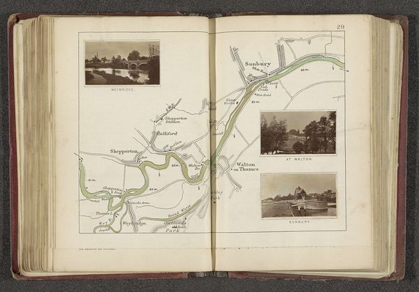
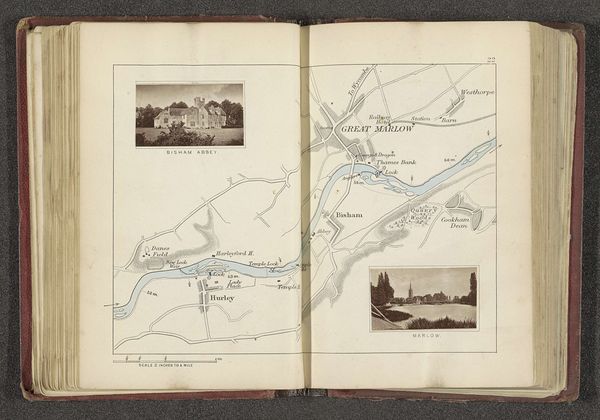
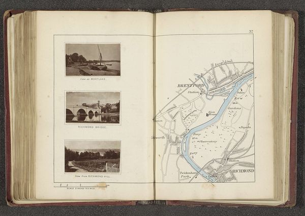
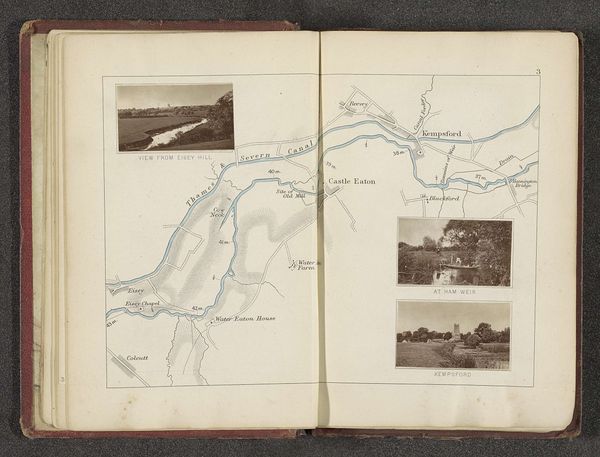
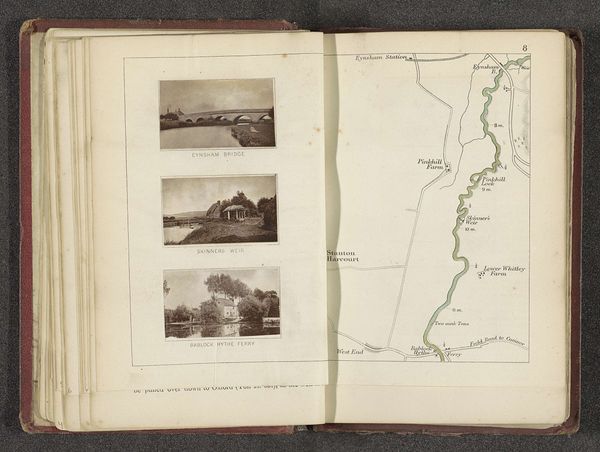
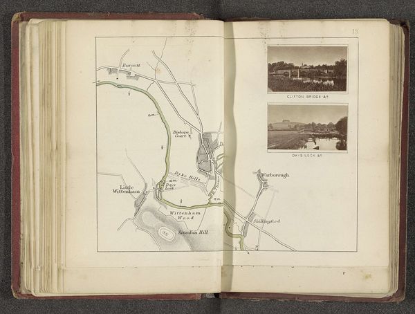
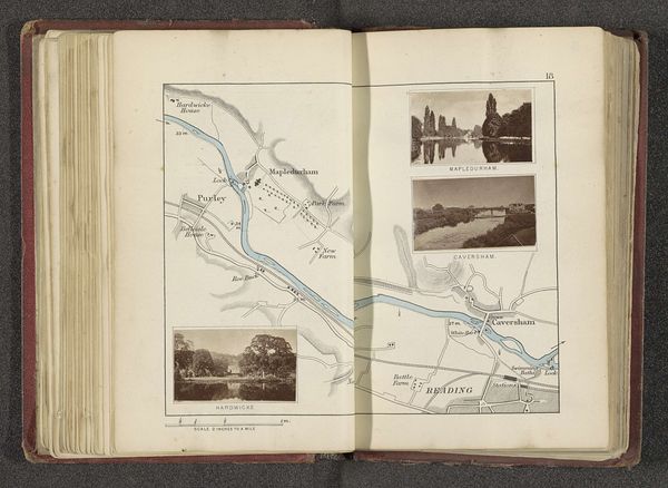
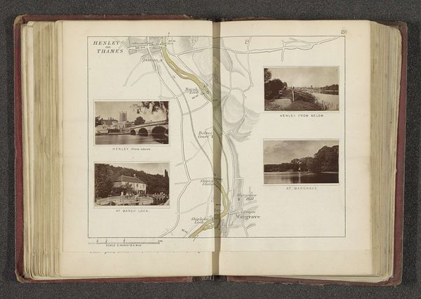
Kaart met drie afbeeldingen van plaatsen langs de Theems in de buurt van Staines en Chertsey before 1879
0:00
0:00
drawing, print, paper, pencil, graphite
#
drawing
# print
#
landscape
#
river
#
paper
#
coloured pencil
#
pencil
#
graphite
#
sketchbook drawing
Dimensions: height 164 mm, width 230 mm
Copyright: Rijks Museum: Open Domain
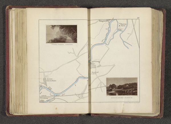
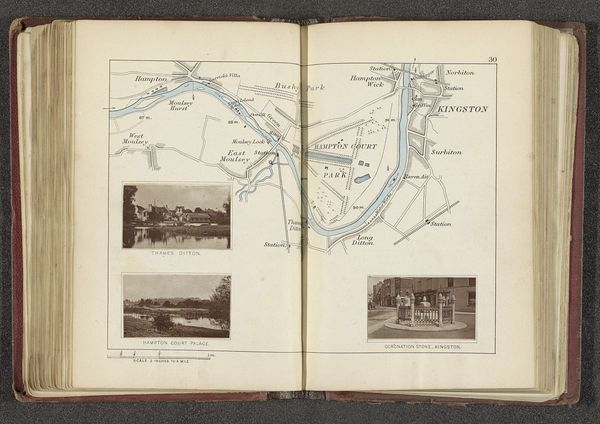
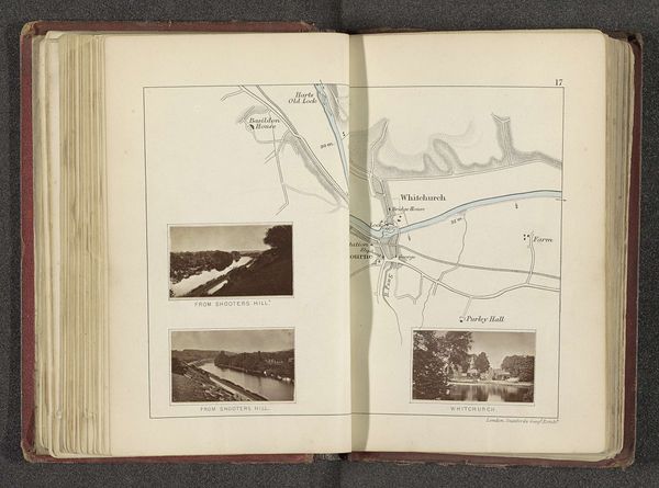
Curator: Here we have "Kaart met drie afbeeldingen van plaatsen langs de Theems in de buurt van Staines en Chertsey," a work attributed to Henry W. Taunt from before 1879. It's a composite of prints and drawings in pencil and graphite on paper. What's your immediate reaction to this page? Editor: My eye is drawn to the three rectangular snapshots—Staines Church, Staines Bridge, Chertsey Lock and Bridge. They’re like little portals into a past England. So orderly, so precise. It almost feels… melancholic, you know? A yearning for a time when distances felt greater. Curator: It's interesting you pick up on that melancholic feeling. These images represent the romanticization of the English countryside, a theme deeply ingrained in the socio-political fabric of the late 19th century, in sharp contrast to the quickening pace of industrialization. Editor: I see what you mean. There’s definitely a sense of preserving something fragile in these drawings. And the map on the facing page reinforces that feeling. It is practical, yes, a record. But, I find myself imagining someone using this, a solitary traveler on a punt, maybe, lost in their own thoughts. It becomes intimate somehow, doesn’t it? Curator: Absolutely. Consider the act of sketching itself, capturing these landscapes at a specific moment. Taunt wasn't merely documenting; he was participating in a dialogue about English identity and history through images. The printing technology facilitated that dialogue to spread wider. Editor: The contrast is beautiful, a rough, imperfect human hand documenting perfection in this time capsule. What about you? I bet there are more meanings than meets the eye here! Curator: Yes, for example, one interpretation, the three carefully composed images emphasize accessibility, connecting different communities through infrastructure – the Church symbolizing spiritual connection, the Bridge facilitating physical connection. Taunt captured his views with paper, graphite, and printing tech. Editor: Beautiful, beautiful points, there really is something incredibly alluring, even inspiring when analyzing our deep connection to English countryside through these pieces of drawings. I think this made me love and admire "Kaart met drie afbeeldingen van plaatsen langs de Theems in de buurt van Staines en Chertsey" much more than ever before!
Comments
No comments
Be the first to comment and join the conversation on the ultimate creative platform.
More like this