print, engraving
# print
#
cityscape
#
engraving
#
realism
Dimensions: height 423 mm, width 333 mm
Copyright: Rijks Museum: Open Domain
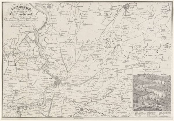
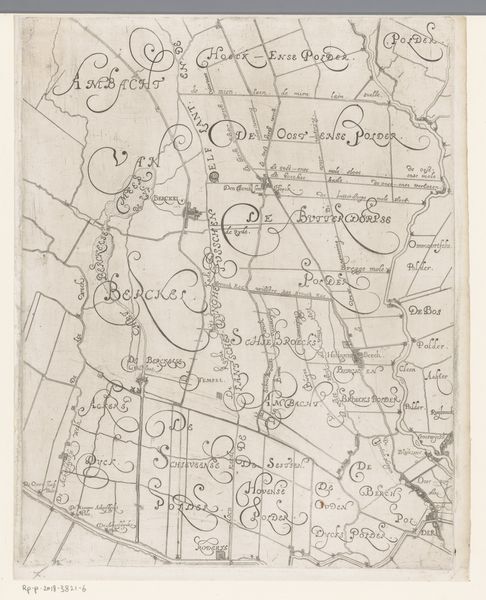
This is an anonymous map of Antwerpen and its surroundings, created in 1832. The first impression is of a network of fine lines meticulously mapping out geographical locations. These lines function as a semiotic system, where each stroke and curve signifies a road, river, or border. Notice how the composition emphasizes the structured, almost architectural layout of the area. The river, acting as a central artery, dictates the flow and organization of the surrounding spaces. This is not just a functional document; it also embodies the 19th-century's obsession with rational ordering and control over the landscape. The map challenges fixed meanings by presenting a subjective view of space and territory. The absence of color directs our attention to the structural framework itself, inviting us to decode the visual components and cultural codes that informed its creation. It is a reminder that maps are not neutral representations but carefully constructed images reflecting specific ideologies.
Comments
No comments
Be the first to comment and join the conversation on the ultimate creative platform.
More like this