print, etching, paper
#
baroque
# print
#
etching
#
etching
#
paper
#
line
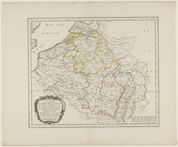
Dimensions: height 423 mm, width 500 mm
Copyright: Rijks Museum: Open Domain
This is an anonymous map of Belgium in Roman times, made with etching. It's an interesting example of how geographical knowledge was constructed and disseminated. The map presents a vision of Belgium shaped by Roman conquest and administration. It's more than just a depiction of space, it's a statement about power and control. Consider the historical context. This map likely reflects the interests and perspectives of those in power. The emphasis on Roman infrastructure serves to legitimize Roman rule and to create a sense of order and control over the territory. How does the act of mapping itself reinforce existing power structures? What other histories were overwritten in the making of this map? Historians delve into such questions, using a range of sources to understand the complex social, political, and economic forces that shaped artistic production. Maps are never neutral.
Comments
No comments
Be the first to comment and join the conversation on the ultimate creative platform.
More like this