drawing, print, etching, pen, engraving
#
drawing
# print
#
etching
#
old engraving style
#
landscape
#
pen-ink sketch
#
pen
#
engraving
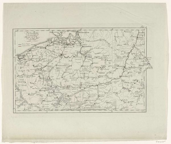
Dimensions: height 344 mm, width 261 mm
Copyright: Rijks Museum: Open Domain
This is Johann David Schleuen's ‘Rechterhelft van een kaart van Holstein’, or right half of a map of Holstein. Made with the printmaking technique of etching, the map is defined by the lines incised into a metal plate, inked, and then pressed onto paper. The character of the print is inextricably linked to this method. Look closely, and you’ll see the subtle variations in line weight achieved by varying the pressure, and the fineness of detail rendered through this process. What’s particularly interesting here is the relationship between craft, information and politics. Maps like this were not just documents but instruments of power. The very act of mapping claims possession, turning land into property and transforming lived experience into abstract data. This map, with its careful rendering and intricate linework, is an example of how craft, in service to political and economic agendas, has been instrumental in shaping the world around us.
Comments
No comments
Be the first to comment and join the conversation on the ultimate creative platform.
More like this