graphic-art, print, etching
graphic-art
baroque
etching
landscape
etching
cityscape
Dimensions: height 451 mm, width 513 mm
Copyright: Rijks Museum: Open Domain
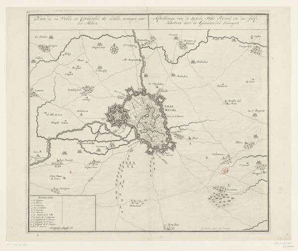
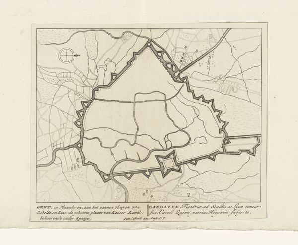
This is an anonymous map of Dunkirk and its surroundings. Unattributed, the map speaks to how places are not simply locations, but embodiments of power dynamics and cultural interactions. Dunkirk, a coastal city, has historically been a strategic point of contention, changing hands between different European powers. This map, with its detailed fortifications, hints at the city's martial importance and the struggles for dominance that shaped its identity. Consider the lives of ordinary people living within these borders. How did these political shifts influence their sense of belonging and daily existence? Maps such as this one are more than geographical tools; they are narratives of conquest, resilience, and the ever-shifting sands of identity. They remind us that every border, every city, tells a story of those who lived, fought, and dreamed within its confines.
Comments
No comments
Be the first to comment and join the conversation on the ultimate creative platform.