drawing, print, paper, ink
#
drawing
#
dutch-golden-age
# print
#
paper
#
ink
#
geometric
#
cityscape
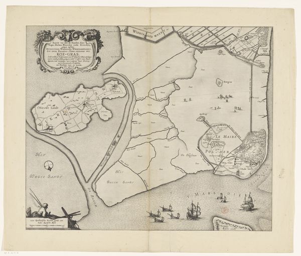
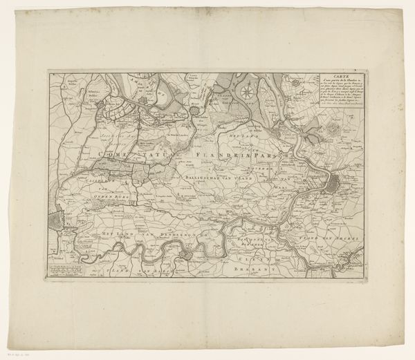
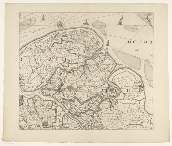
Dimensions: height 465 mm, width 532 mm
Copyright: Rijks Museum: Open Domain
Curator: Before us hangs "Kaart van Zeeland (tweede deel)," an anonymous map dating from around 1655 to 1725. It's rendered in ink on paper using drawing and print techniques. What's your immediate impression? Editor: The whole thing shimmers with a calm energy. The thin lines tracing land and water evoke a dreamlike stillness. And yet, I can feel the implied hustle and bustle of these early modern port cities, can almost smell the salt air! Curator: Note the precise geometric structuring of space, carefully delineating land masses and waterways. Observe the linework—the fine hatching used to indicate varying depths, the slightly bolder lines that define the land boundaries. How do these elements communicate spatial relationships? Editor: You're right, it's very organized. Almost shockingly so, given the era. Yet there's also something quite whimsical about it, perhaps the tiny boats floating in the open water, looking a bit like toys. Also, the hand-drawn text adds a really special human touch to what might otherwise seem like a cold, purely cartographic endeavor. Curator: The work's subtle tonality emerges from layering delicate lines and the variation of ink density. Consider also the implied presence of the cartographer's hand—a skilled draftsman diligently recording and organizing geographical knowledge. Editor: Yes! And thinking about that draftsman... imagining them perched somewhere with all those pens and inkwells… the detail is mesmerizing. Also I love maps, generally! There’s something about visualizing a space like this; the desire to capture a place, it reflects an essential human longing. A hope for orientation and meaning! Curator: Precisely! This map exemplifies a scientific impulse, a striving to catalog and rationalize the world. Editor: Exactly. What do you feel when you consider it? Curator: The map functions as a complex semiotic system—encoding geographic, economic, and sociopolitical information within its graphic language. It serves as an important record, revealing not only the region’s physical landscape but also the cognitive frameworks of its creators and users. Editor: For me, I just love the texture of time and the way it transports me. Curator: A fine point. Thank you. Editor: My pleasure.
Comments
No comments
Be the first to comment and join the conversation on the ultimate creative platform.
More like this