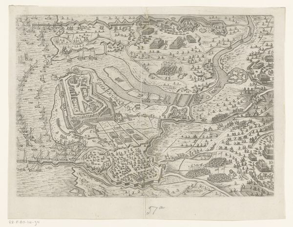
Kaart van de polder het Koegras met daarop de Le Maires polder 1640 - 1652
anonymous
Rijksmuseum
print, engraving
dutch-golden-age
landscape
form
geometric
line
cityscape
engraving
Dimensions: height 467 mm, width 564 mm
Copyright: Rijks Museum: Open Domain
This map of the Koegras polder, including the Le Maires polder, was made anonymously in the Netherlands. The map presents a visual representation of land reclamation, a defining feature of the Dutch landscape and its economic history. The detailed depiction of the polders reflects the Dutch mastery of hydraulic engineering and their relentless efforts to create and control land. The map is covered with a network of waterways, dikes, and plots, illustrating the human intervention necessary to transform the natural landscape into productive agricultural land. The map should be considered within the broader context of Dutch maritime power and economic expansion during the early modern period. Maps like this were not merely descriptive tools; they were instruments of power, asserting control over territory. To fully understand the significance of this map, researchers can delve into archives of the water boards responsible for managing the polders, and historical records. Doing so will reveal the social conditions that shaped this artistic production.
Comments
No comments
Be the first to comment and join the conversation on the ultimate creative platform.