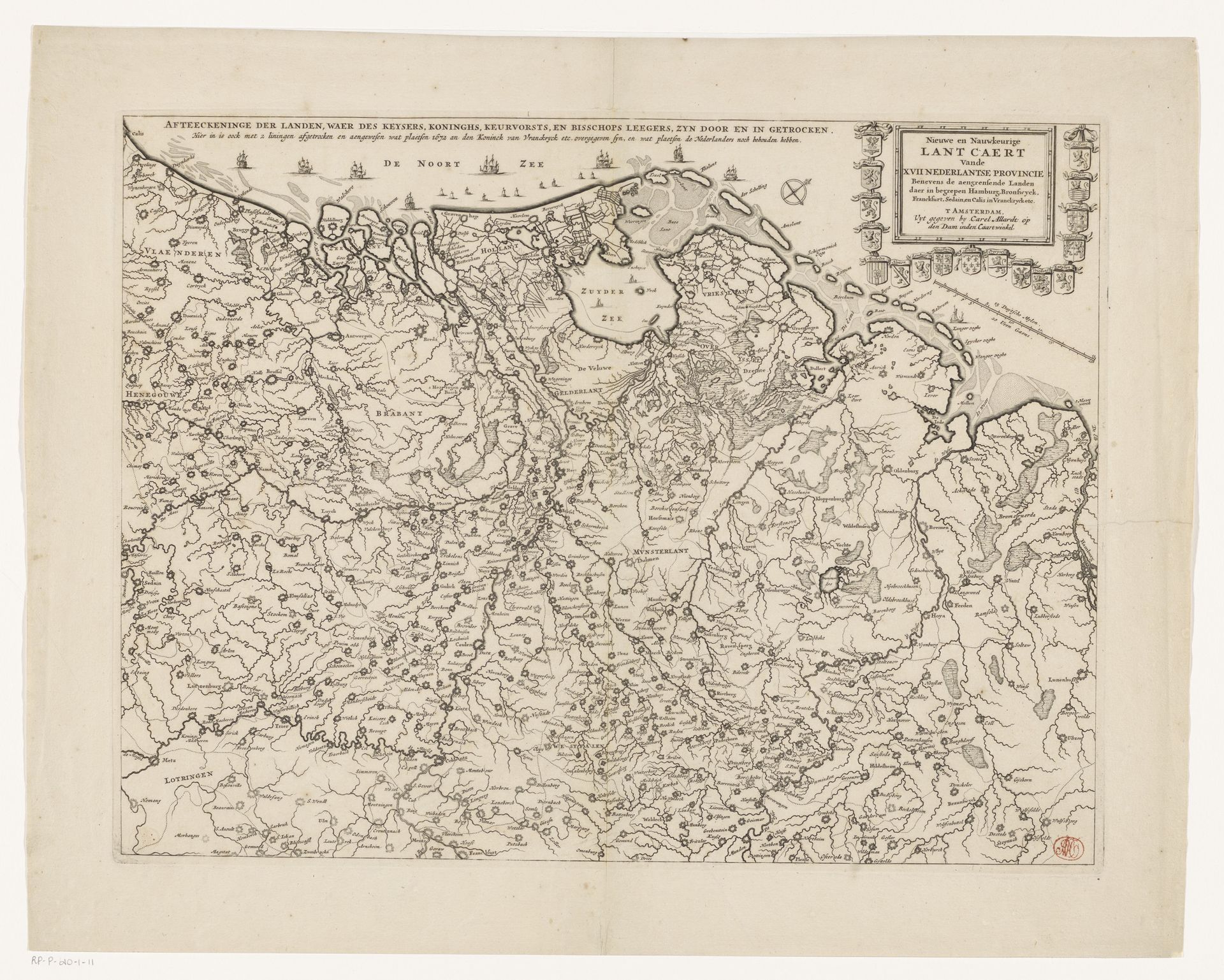
1672 - 1706
Kaart van de Nederlanden met de oorlogssituatie van 1672-73
Anonymous
@anonymousLocation
RijksmuseumListen to curator's interpretation
Curatorial notes
Curator: Here we have an intriguing graphic from the Dutch Golden Age, dating roughly from 1672 to 1706. It's a print titled "Kaart van de Nederlanden met de oorlogssituatie van 1672-73"—or, "Map of the Netherlands with the war situation of 1672-73." Editor: My immediate sense is of meticulously organized chaos. The density of detail, all those swirling lines representing land and water, conveys a feeling of being overwhelmed by information—as if you’re right in the middle of it all, a state of conflict, which probably parallels what many felt back then. Curator: The artist, whose name is unfortunately lost to history, employed the technique of engraving to depict this landscape. Look at the confident strokes used to delineate borders, both geographical and political. Note also the geometric precision in how bodies of water are rendered, contrasted by a more impressionistic take on landmasses. Editor: Yes, and those political borders are absolutely critical, literally defining territories during a period of intense struggle. It’s hard to separate the geography from the geopolitics; it is all interconnected here. Think about who this map was intended for, and how it likely informed decision-making processes regarding strategic operations, movement of peoples and resources, trade routes, or alliances between different actors. It reveals the spatial dimension of political relationships. Curator: Exactly, and we shouldn't overlook the cityscape elements scattered across the artwork. They aren’t merely topographical markers, but nodes of economic and political power. Furthermore, their distribution subtly indicates relationships in trade and communication, as much as who occupied those areas. Editor: I find it difficult not to consider this artifact within the broader historical context of Dutch colonialism and maritime power, when maps weren’t merely passive reflections of the world but powerful tools for claiming ownership. I keep thinking of post-colonial cartography: it reclaims indigenous spatial knowledge. Curator: Yes, looking closely we also recognize certain cartographic conventions – lettering sizes that signify urban settlement populations – which gives us another metric by which to evaluate historical trade systems of power, as well as Dutch imperial ambitions during that specific time. Editor: It all comes together, really, making this work far more complex than its rather unassuming initial appearance suggests. It becomes a mirror, then—a way of viewing not just the lay of the land, but how the society was organized along its spatial lines. Curator: Agreed. A fascinating example of cartography as both a science and a subjective rendering of reality, then, revealing strategic concerns as much as geographical features. Editor: Precisely. It prompts us to critically examine power relations in this pivotal period of conflict, demonstrating how something seemingly objective like a map can subtly articulate and propagate certain ideological visions.