About this artwork
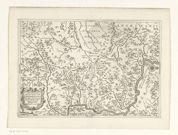
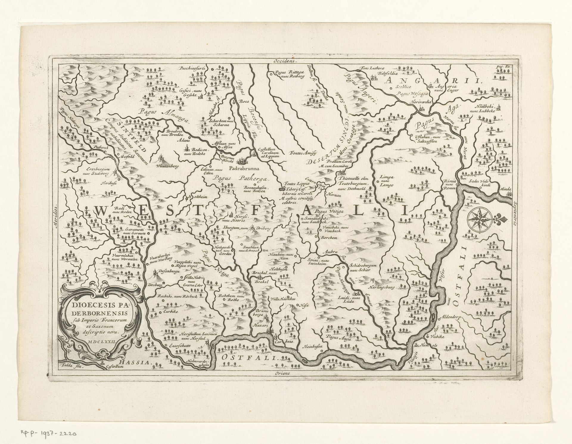
This is Jan Matthysz’s “Kaart van Westfalen”, a detailed map rendered with ink on paper. The composition is dominated by a dense network of fine lines, forming a complex topography of rivers, borders, and settlements. These lines are not merely representational; they construct a visual language that invites us to decode the spatial and political organization of Westphalia. The map presents a semiotic system of signs, where each line, symbol, and text functions as a signifier. Matthysz uses cartographic symbols, such as miniature building icons, to represent settlements and strategic points. Consider how the density and placement of these signs reflect not only geographical accuracy but also power relations. The meticulous labeling of regions and towns further encodes layers of meaning. The map's structure and form challenge the viewer to consider how space is constructed and perceived. It serves as a historical artifact and an exercise in visual interpretation, reminding us that maps are not neutral representations but rather active constructions of knowledge.
Artwork details
- Medium
- print, engraving
- Dimensions
- height 183 mm, width 265 mm
- Copyright
- Rijks Museum: Open Domain
Tags
Comments
Share your thoughts
About this artwork
This is Jan Matthysz’s “Kaart van Westfalen”, a detailed map rendered with ink on paper. The composition is dominated by a dense network of fine lines, forming a complex topography of rivers, borders, and settlements. These lines are not merely representational; they construct a visual language that invites us to decode the spatial and political organization of Westphalia. The map presents a semiotic system of signs, where each line, symbol, and text functions as a signifier. Matthysz uses cartographic symbols, such as miniature building icons, to represent settlements and strategic points. Consider how the density and placement of these signs reflect not only geographical accuracy but also power relations. The meticulous labeling of regions and towns further encodes layers of meaning. The map's structure and form challenge the viewer to consider how space is constructed and perceived. It serves as a historical artifact and an exercise in visual interpretation, reminding us that maps are not neutral representations but rather active constructions of knowledge.
Comments
Share your thoughts