About this artwork
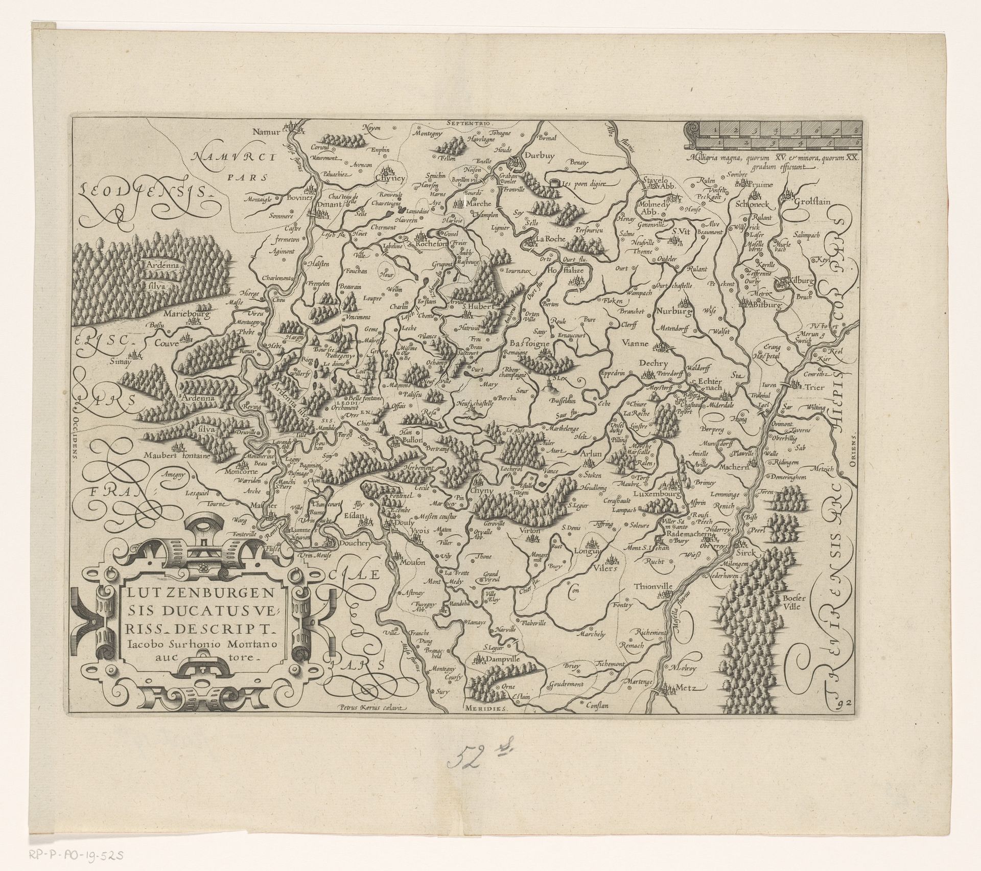
Pieter van der Keere made this map of Luxembourg in the late 16th or early 17th century. The dominant visual symbols are the forests and rivers, indicating not just geographical features, but their economic and strategic importance. Notice how these forests are rendered, almost like clusters of stylized trees, recalling the symbolic forests found in medieval tapestries or even illuminated manuscripts. The forest, across cultures, often represents the unknown, a place of danger but also of transformation and renewal. Consider the recurrence of the ‘wild man’ motif, so prevalent in Northern European art—he is forever associated with the untamed wilderness. In van der Keere's map, the presence of these dense forests speaks to an emotional, subconscious understanding of the land. It’s a space where boundaries blur, where the rational gives way to the primal. This emotional charge, embedded in the depiction of landscape, resurfaces time and again. It is a cycle as old as humanity itself, forever evolving.
Artwork details
- Medium
- drawing, paper, ink, engraving
- Dimensions
- height 239 mm, width 315 mm
- Location
- Rijksmuseum
- Copyright
- Rijks Museum: Open Domain
Tags
Comments
Share your thoughts
About this artwork
Pieter van der Keere made this map of Luxembourg in the late 16th or early 17th century. The dominant visual symbols are the forests and rivers, indicating not just geographical features, but their economic and strategic importance. Notice how these forests are rendered, almost like clusters of stylized trees, recalling the symbolic forests found in medieval tapestries or even illuminated manuscripts. The forest, across cultures, often represents the unknown, a place of danger but also of transformation and renewal. Consider the recurrence of the ‘wild man’ motif, so prevalent in Northern European art—he is forever associated with the untamed wilderness. In van der Keere's map, the presence of these dense forests speaks to an emotional, subconscious understanding of the land. It’s a space where boundaries blur, where the rational gives way to the primal. This emotional charge, embedded in the depiction of landscape, resurfaces time and again. It is a cycle as old as humanity itself, forever evolving.
Comments
Share your thoughts