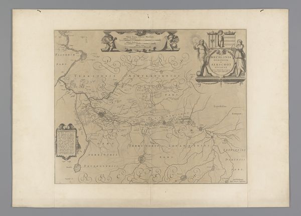
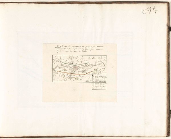
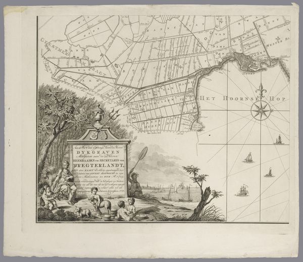
Kaart van het gebied tussen Den Bosch en Geertruidenberg met dijkdoorbraken (vijfde blad) before 1757
0:00
0:00
print, etching
#
medieval
# print
#
etching
#
landscape
#
etching
#
history-painting
Dimensions: height 302 mm, width 459 mm
Copyright: Rijks Museum: Open Domain
Editor: Before us is an intriguing etched print. Dating from before 1757, it's titled "Kaart van het gebied tussen Den Bosch en Geertruidenberg met dijkdoorbraken (vijfde blad)." This detailed map illustrates the area between Den Bosch and Geertruidenberg, focusing specifically on the locations of levee breaches. What strikes you immediately about it? Curator: The sheer density of information, for one. It speaks to a cartographic impulse – a desire to delineate, categorize, and ultimately, control space through representation. And the neat, almost bureaucratic rendering of the landscape...fascinating. Editor: I agree; control does seem central here, but perhaps less about some abstract ordering of space and more rooted in something extremely tangible: managing water. We see a landscape dramatically shaped – and disrupted – by infrastructural choices. I wonder about the labor that built these dikes, the materials they used, the communities dependent on them... Curator: An insightful material analysis! Yet, consider also how the image presents itself formally. Note the balance, the visual hierarchy established by the swirling cartouche at the bottom; these stylistic flourishes are not mere decoration. They structure our engagement, guiding our gaze strategically. Editor: Absolutely. But these "flourishes", as you call them, also tell a story about craftsmanship. They demonstrate the etcher's skills. Moreover, maps like this weren't just scientific tools; they were commodities. They entered a marketplace and reflect the social and economic value placed upon this kind of knowledge production. Who used them and who paid for them is as much of a focus for understanding it for me. Curator: Indeed. And in viewing this 'landscape', one might consider that there's a subtle contrast at play: between the seemingly objective, measurable representation of the terrain and the undeniable presence of human intervention – even fallibility, if the dike breaches are any indication. Editor: Perhaps the contrast exists beyond fallibility. Dike building represents immense collective human agency acting *upon* nature and the etcher is illustrating those impacts. It's far more dynamic of a relationship than fallibility might suggest; society constantly reshaping and being reshaped *by* water management challenges. Curator: Very compelling. This dialogue highlights precisely why engaging with art—even something as seemingly functional as a map—demands a multiplicity of viewpoints, isn't that right? Editor: Precisely. Only by synthesizing these perspectives can we truly grasp the multifaceted story embedded within a seemingly straightforward artifact like this.
Comments
No comments
Be the first to comment and join the conversation on the ultimate creative platform.
More like this