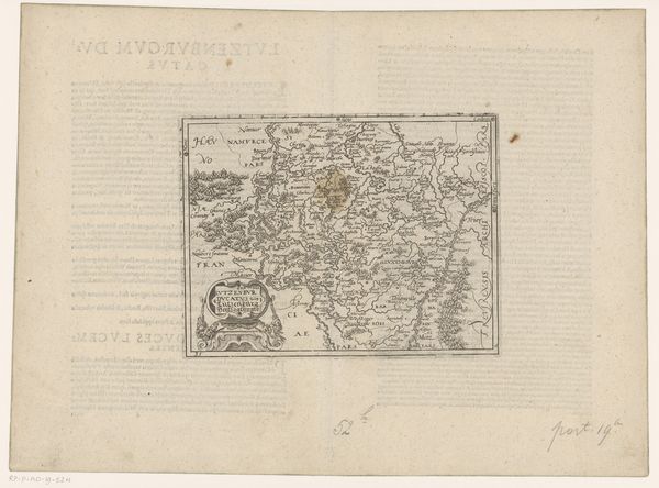
Kaart van het hertogdom Limburg, het land van Valkenburg en het heerlijkheid Dalem 1598
0:00
0:00
franshogenberg
Rijksmuseum
drawing, print, etching, paper
#
drawing
# print
#
etching
#
etching
#
paper
Dimensions: height 147 mm, width 193 mm
Copyright: Rijks Museum: Open Domain
Frans Hogenberg created this map of the Duchy of Limburg around the late 16th century. Notice how the land is rendered, filled with symbols of power and possession. The map isn't just a guide, it's a statement. The coats of arms, prominently displayed, aren't mere decorations, but declarations of dominion. The map itself becomes a territory claimed, echoing the heraldic emblems of control. We see this impulse repeated across time; consider the classical Roman maps that codified the empire's reach. The act of mapping transcends simple geography. It's a psychological act, a way to tame the unknown. The emotional resonance of claiming space – to map, to name, to possess – taps into primal instincts of security and control. The power in these symbols, the map and emblems, isn't linear; it recurs, shifts, and persists, molded by successive generations imprinting their desires onto the land.
Comments
No comments
Be the first to comment and join the conversation on the ultimate creative platform.
More like this